Salem in Essex County, Massachusetts — The American Northeast (New England)
Salem Harbor
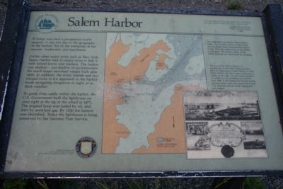
Unlike other major ports such as New York, Salem Harbor had no major river to link it with inland towns and markets. The harbor was shallow – too shallow to accommodate the much larger merchant vessels built after 1850. In addition, the many islands and submerged rocks at the approach to the harbor made navigating dangerous at night or in thick weather.
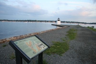
To guide ships safely within the harbor, the U.S. Government built the lighthouse on your right at the tip of the wharf in 1871. The original lamp was fueled by oil, and later by acetylene gas. By 1930 the lantern was electrified. Today the lighthouse is being preserved by the National Park Service.
Erected by U.S. Park Service.
Topics. This historical marker is listed in these topic lists: Industry & Commerce • Settlements & Settlers • Waterways & Vessels. A significant historical year for this entry is 1850.
Location. Marker has been reported missing. It was located near 42° 31.027′ N, 70° 53.056′ W. Marker was in Salem, Massachusetts, in Essex County. Marker could be reached from Derby Street, 0.3 miles south of Orange Street. This historical marker is located in the Salem Maritime, National Historic Site, about 2/3 of the way out on the Derby Wharf. Touch for map. Marker was at or near this postal address: 174 Derby St, Salem MA 01970, United States of America. Touch for directions.
Other nearby markers. At least 8 other markers are within walking distance of this location. Friendship of Salem (approx. ¼ mile away); a different marker also named Friendship of Salem (approx. ¼ mile away); Pedrick Store House, 1770 (approx. ¼ mile away); Wharves in the Early 1800s (approx. ¼ mile away); The Point Neighborhood (approx. 0.3 miles away); Derby Wharf (approx. 0.3 miles away); Wharves in the late 1800's (approx. 0.3 miles away); Central Wharf (approx. 0.3 miles away). Touch for a list and map of all markers in Salem.
More about this marker. This marker was replaced by a new marker of the same name with slightly different text.
Credits. This page was last revised on June 16, 2016. It was originally submitted on October 26, 2009, by Dale K. Benington of Toledo, Ohio. This page has been viewed 981 times since then and 6 times this year. Last updated on July 31, 2015, by J. Makali Bruton of Accra, Ghana. Photos: 1, 2. submitted on October 26, 2009, by Dale K. Benington of Toledo, Ohio. 3. submitted on October 27, 2009, by Dale K. Benington of Toledo, Ohio. • Bill Pfingsten was the editor who published this page.


