
Sibley in Jackson County, Missouri — The American Midwest (Upper Plains)
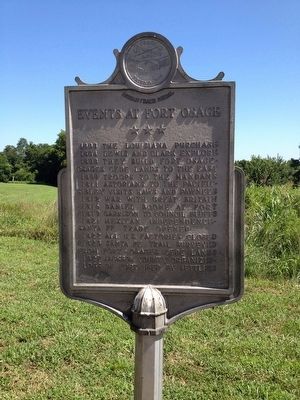
Events at Fort Osage
Photographed by Michael W. Kruse, July 31, 2015
1. Events at Fort Osage Marker
1803 The Louisiana Purchase
1804 Lewis and Clark Explore
1808 They build Fort Osage - Osages cede lands to the east
1809 Troops to the Mandans
1811 Astorians to the Pacific - Sibley visits Kaws and Pawnees
1812 War with Great Britain
1816 Daniel Boone at Fort
1819 Garrison to Council Bluffs
1821 Mexican Independence - Santa Fe trade opens
1822 All U.S. factories closed
1825 Santa Fe Trail surveyed from Fort - Osages cede lands
1827 Jackson County organized - Logs of port used by settlers
Reverse
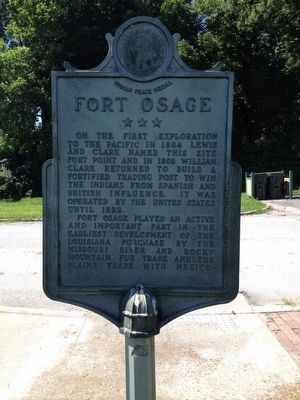
Fort Osage
On the first exploration to the Pacific in 1804 Lewis and Clark named this site Fort Point and in 1808 William Clark returned to build a fortified post to win the Indians from Spanish and British influence. It was operated by the United States until 1822.
Fort Osage played an active and important part in the earliest development of the Louisiana Purchase by the Missouri River and Rocky Mountain fur trade and the plains trade with Mexico.
Topics and series. This historical marker is listed in these topic lists: Exploration • Forts and Castles • Indigenous Peoples and Communities •
this page online
Location. 39° 11.231′ N, 94° 11.604′ W. Marker is in Sibley, Missouri, in Jackson County. It is on 3rd Street. Touch for map. Marker is in this post office area: Sibley MO 64088, United States of America. Touch for directions.

Regionally, this marker is in Greater Kansas City. It is also in the American Midwest, in the Lewis & Clark Corridor, in the Corn Belt, and on the Santa Fe Trail Corridor. Globally, it is in North America, the Western Hemisphere, the Western World, and the Anglosphere. Historically, it finds itself in what was once the territory of the Mississippian Culture, the Louisiana Purchase, and the Antebellum South.
Other nearby markers. At least 8 other markers are within 8 miles of this marker, measured as the crow flies: Restoration of Fort Osage (about 400 feet away, measured in a direct line); Fort Osage (about 500 feet away); a different marker also named Fort Osage (approx. 3 miles away); Santa Fe Trail (approx. 3.4 miles away); a different marker also named
Photographed by Michael W. Kruse, July 31, 2015
2. Events at Fort Osage Marker Reverse
Photographed by Michael W. Kruse, July 31, 2015
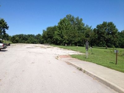
3. Events at Fort Osage Marker
Located in the north parking lot.

circa 1972
4. Events at Fort Osage Marker
The marker as it appeared in about 1972.
Credits. This page was last revised on December 1, 2025. It was originally submitted on July 31, 2015, by Michael W. Kruse of Kansas City, Missouri. This page has been viewed 625 times since then and 29 times this year. Photos: 1, 2, 3. submitted on July 31, 2015, by Michael W. Kruse of Kansas City, Missouri. 4. submitted on December 1, 2025, by Charles Berman of Binghamton, New York. • Bill Pfingsten was the editor who published this page.
