
Conway in Horry County, South Carolina — The American South (South Atlantic)
Centennial Time Capsule
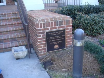
Photographed by J. J. Prats, February 6, 2007
1. Centennial Time Capsule Marker
Erected 2003 by the Horry County Government, Conway, SC.
Topics and series. This historical marker is listed in this topic list: Notable Events. In addition, it is included in the Time Capsules series list. A significant historical date for this entry is December 9, 1746.
Location. 33° 49.945′ N, 79° 2.917′ W. Marker is in Conway, South Carolina, in Horry County. It is at the intersection of 2nd Avenue and Beaty Street, on the right when traveling east on 2nd Avenue. Marker is on the main entrance to the Horry County Government and Justice Center, facing Beaty Street, to the right of the steps. Touch for map. Marker is at or near this postal address: 1301 Second Avenue, Conway SC 29526, United States of America. Touch for directions.

Regionally, this marker is in South Carolina’s Pee Dee. It is also in the American South, specifically in the Deep South, and on the Eastern Seaboard. Globally, it is in the North Atlantic Region, North America, the Western Hemisphere, the Western
this page online
Other nearby markers. At least 5 other markers are within walking distance of this marker: General Peter Horry (about 400 feet away, measured in a direct line); Horry County Veterans Memorial (about 500 feet away); Pentagon Limestone (about 500 feet away); High Water Mark Hurricane Florence (about 500 feet away); Peter Horry / Horry County (about 500 feet away). Touch for a list and map of all markers in Conway.
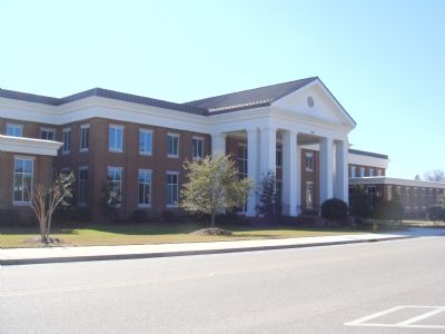
Photographed by J. J. Prats, February 6, 2007
2. Horry County Government and Justice Center
Credits. This page was last revised on July 14, 2019. It was originally submitted on February 18, 2007, by J. J. Prats of Powell, Ohio. This page has been viewed 1,890 times since then and 35 times this year. Photos: 1, 2. submitted on February 18, 2007, by J. J. Prats of Powell, Ohio.
