St. James in St. James Parish, Louisiana — The American South (West South Central)
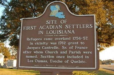
Site of First Acadian Settlers in Louisiana
Inscription.
Refugees came overland 1756-57. In vicinity was 1762 grant to Jacques Cantrelle, Sr. of France after whom Church and Parish were named. Section once included in Les Oumas, Eveche of Quebec.
Erected 1961 by Department of Commerce and Industry.
Topics and series. This historical marker is listed in these topic lists: Colonial Era • Settlements & Settlers • War, French and Indian. In addition, it is included in the Acadian History series list. A significant historical year for this entry is 1762.
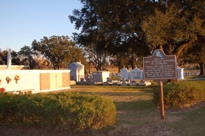
Location. 30° 0.936′ N, 90° 50.487′ W. Marker is in St. James, Louisiana, in St. James Parish. Marker is on River Rd. (State Highway 18) 0.2 miles south of Dept. Of Energy Rd., on the left when traveling south. Touch for map. Marker is in this post office area: Saint James LA 70086, United States of America. Touch for directions.
Other nearby markers. At least 8 other markers are within 3 miles of this marker, measured as the crow flies. St. Jacques de Cabahanoce (about 300 feet away, measured in a direct line); Judge Poché Plantation House (approx. 0.8 miles away); Convent (approx. 0.9 miles away); Uncle Sam Plantation (approx. 1½ miles away); The Settlement Of Freetown (approx. 2 miles away); Manresa House of Retreats (approx. 2 miles away); Cabahanoce Plantation (approx. 2.4 miles away); Malarcher House (approx. 2.6 miles away). Touch for a list and map of all markers in St. James.
Credits. This page was last revised on December 11, 2022. It was originally submitted on August 2, 2015. This page has been viewed 1,559 times since then and 111 times this year. Last updated on August 2, 2015. Photos: 1, 2. submitted on August 2, 2015. • Bill Pfingsten was the editor who published this page.

