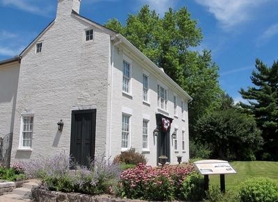
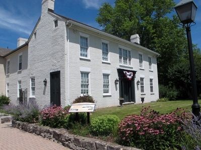
Buena Vista Tavern
The Historic National Road in Ohio
| — | Nineteenth and Early Twentieth Century Travel Accommodations | — |
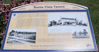
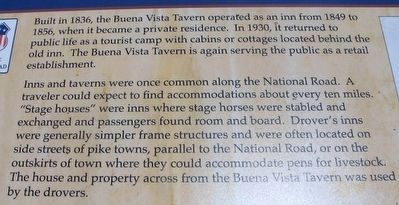
Inns and taverns were once common along the National Road. A traveler could expect to find accommodations about every ten miles. “Stage Houses” were inns where stage horses were stabled and exchanged and passengers found room and board. Drover’s inns were generally simpler frame structures and were often located on side streets of pike towns, parallel to the National Road, or on the outskirts of town where they could accommodate pens for livestock. The house and property across from the Buena Vista Tavern was used by the drovers.
(Photograph w/caption)
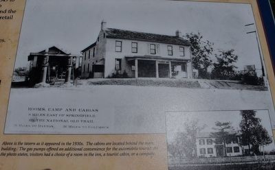
Rooms, camp and cabins
9 miles east of Springfield
on the National Old Trail
36 miles to Dayton 36 miles to Columbus
Above is the tavern as it appeared in the 1930’s. The cabins are located behind the main
building. The gas pumps offered an additional
this page online
(Photograph)
Early “auto tourists” slept in farmer’s fields, using tents attached to their cars or small travel trailers. Public, and then private tourist camps developed in the 1910’s and 1920’s in response to the growing number of overnight travelers. Cabin camps were the earliest lodging specifically built to accommodate the National Road traveler. They were usually grouped in a row or crescent- shaped arraignment to provide nearby parking. Cottages
were larger, more durable, and were winterized for year- round use. Beginning in the 1940’s, cottages were succeeded by motor courts and motels which integrated all the rooms under a continuous roofline. By the 1950’s, many motor courts and motels added coffee shops and restaurants.
(Photograph w/caption)
34 mi. west of Zanesville 20 mi. east of Columbus
Majestic Tourist Camp
J.G.Rosecrans prop.
gas, oil and eats
rooms, bath and cottages
Ladies rest room
Pataskela Ohio R.D.
National Road 1 mi. west of Kirkersville
courtesy
Pictured above is a typical tourist camp along the National Road. The services and layout are similar to that of the Buena Vista Tavern during the same period.
The Road That Helped Build the Nation
An All American Road- National Byway
presented by the National Road Association, Inc.
sponsored by the Phillip B. Johnson Family
Erected by National Road Association, Inc. Phillip B. Johnson Family.
Topics and series. This historical marker is listed in these topic lists: Roads & Vehicles • Settlements & Settlers. In addition, it is included in the The Historic National Road series list. A significant historical year for this entry is 1836.
Location. 39° 55.598′ N, 83° 38.703′ W. Marker is near South Vienna, Ohio, in Clark County. It is in Hollandia View. It is at the intersection of Old National Road (U.S. 40) and Buena Vista road (County Route 92), on the right when traveling west on Old National Road. Touch for map. Marker is at or near this postal address: 101 Buena Vista Rd, South Vienna OH 45369, United States of America. Touch for directions.
Regionally, this marker is in the Dayton Metro and
Other nearby markers. At least 8 other markers are within 6 miles of this marker, measured as the crow flies: Asbury Veterans Monument (approx. 2½ miles away); Asbury Methodist Church (approx. 2½ miles away); Pleasant Township Veterans Memorial (approx. 4.6 miles away); A Relict from an Icy Past (approx. 5.8 miles away); Ohio Buckeye Tree (approx. 6 miles away); Ohio Native Plants (approx. 6 miles away); Ohio's Physiographic Regions (approx. 6 miles away); a different marker also named Ohio Native Plants (approx. 6.1 miles away). Touch for a list and map of all markers in South Vienna.
Additional keywords. National Road
Credits. This page was last revised on February 7, 2023. It was originally submitted on August 5, 2015, by Rev. Ronald Irick of West Liberty, Ohio. This page has been viewed 996 times since then and 53 times this year. Photos: 1, 2, 3, 4, 5, 6, 7. submitted on August 5, 2015, by Rev. Ronald Irick of West Liberty, Ohio. • Bill Pfingsten was the editor who published this page.
