Leavenworth in Leavenworth County, Kansas — The American Midwest (Upper Plains)
Saint Mary
1859
Photographed by William Fischer, Jr., June 19, 2015
1. Saint Mary Marker
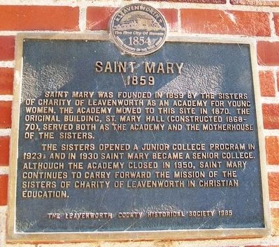
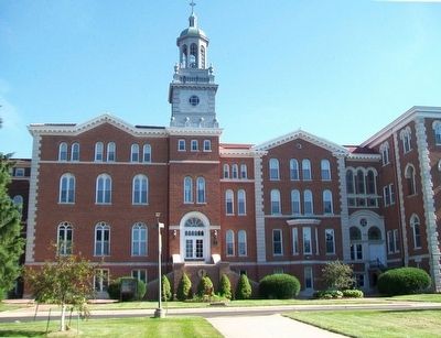
Saint Mary was founded in 1859 by the Sisters of Charity of Leavenworth as an academy for young women. The academy moved to this site in 1870. The original building, St. Mary Hall (constructed 1868-70), served both as the Academy and the Motherhouse of the Sisters.
The Sisters opened a junior college program in 1923; and in 1930 Saint Mary became a senior college. Although the academy closed in 1950, Saint Mary continues to carry forward the mission of the Sisters of Charity of Leavenworth in Christian education.
Erected 1985 by The Leavenworth County Historical Society.
Topics. This historical marker is listed in these topic lists: Education • Religion & Religious Structures • Women. A significant historical year for this entry is 1859.
Location. 39° 16.646′ N, 94° 54.397′ W. Marker is in Leavenworth, Kansas, in Leavenworth County. It can be reached from South 4th Street. Marker is near the entrance to St. Mary Hall, on the university campus. Touch for map. Marker is at or near this postal address: 4100 4th Street Trafficway, Leavenworth KS 66048, United States of America. Touch for directions.

Regionally,
this page online
Other nearby markers. At least 8 other markers are within walking distance of this marker: "Women of the West" (approx. 0.3 miles away); Glacial Hills Scenic Byway (approx. 0.4 miles away); a different marker also named Glacial Hills Scenic Byway (approx. 0.4 miles away); Frontier Military Historic Byway (approx. 0.4 miles away); a different marker also named Frontier Military Historic Byway (approx. 0.4 miles away); Veterans Administration Center (approx. 0.4 miles away); CPL David M. Unger (approx. 0.4 miles away); William J. Mulvihill (approx. 0.4 miles away). Touch for a list and map of all markers in Leavenworth.
Also see . . . A History of the University of Saint Mary. University website entry (Submitted on August 5, 2015, by William Fischer, Jr. of Reynoldsburg, Ohio.)
Photographed by William Fischer, Jr., June 19, 2015
2. Saint Mary Hall and Marker
Photographed by William Fischer, Jr., June 19, 2015
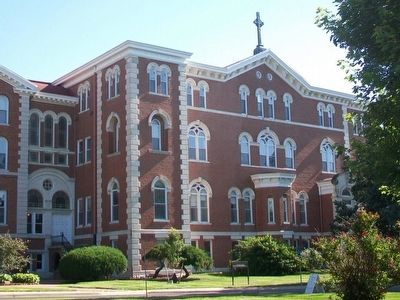
3. Saint Mary Hall, West Wing
Credits. This page was last revised on March 15, 2023. It was originally submitted on August 5, 2015, by William Fischer, Jr. of Reynoldsburg, Ohio. This page has been viewed 790 times since then and 46 times this year. Photos: 1, 2, 3. submitted on August 5, 2015, by William Fischer, Jr. of Reynoldsburg, Ohio.
