Bayeux in Calvados, Normandy, France — Western Europe
La Rue Saint-Jean
Rue Saint-Jean
| — | Bayeux, la Qualité a ses Racines | — |
Photographed by Kevin W., June 30, 2015
1. La Rue Saint-Jean Marker

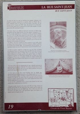
On trouve dans la rue différents bâtiments remontant au Moyen Age, caractérisés par leur façade formée d'un haut pignon triangulaire (n° 15-17-37). La plus imposante de ces demeures se situe au fond de l'impasse des n°51 et 53. Il s'agit d'un manoir de la fin du XVe siècle. Il possède une puissante et haute tour d'escalier de forme carrée à laquelle est accolée à partir du deuxième étage une tourelle cylindrique. On trouve à sa base une tête sculptée, seule fantaisie de cette habitation qui est l'une des rares demeures monumentales du faubourg.
Un blason, orné d'un croissant de lune encadré de trois étoiles, placé au-dessus d'une fenêtre située à l'entrée de l'impasse, indique la présence en ces lieux d'une famille noble.
this page online
La halle aux grains, implantée à l'angle de la rue aux Coqs, est formée d'un bâtiment datant de la première moitié du XIXe siècle qui conserve le même emplacement depuis le Moyen Age. Le roi saint Louis, au XIIIe siècle, fit donation de la halle-au-blés, aussi appelée Tripot, aux religieux chargés de la gestion de l'hôtel-Dieu (hôpital) qui en tiraient un revenu conséquent. C'est ici que se vendaient autrefois les céréales récoltées dans le Bessin, riche terroir agricole dont Bayeux est la capitale commerciale et administrative.
The name of this street has changed down the ages, originally indicating the craft activities of this district. From the 17th century it became known as Rue Saint-Jean after the patron saint of the most densely populated and poorest parish in the city, of which it was the centre.
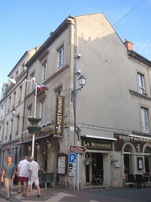
In this street we can find several buildings from the Middle Ages, characterized by their facades framed by a tall triangular gable (n° 15-17-37). The most prestigious of these dwellings is situated at the end
Photographed by Kevin W., June 30, 2015
2. La Rue Saint-Jean Marker
A coat of arms, embellished with a crescent moon framed by three stars, indicates that a noble family once lived here.
The grain market, located on the corner of the Rue aux Coqs, consists of a building dating from the first half of the 14th century and the market has been on the same site since the Middle Ages. This is where the cereal crops harvest in the Bessin area, a rich agricultural region with Bayeux as its capital, used to be bought and sold.
Erected by La ville de Bayeux. (Marker Number 19.)
Topics and series. This historical marker is listed in these topic lists: Industry & Commerce • Roads & Vehicles • Settlements & Settlers. In addition, it is included in the France - Bayeux - Circuit du Vieux Bayeux series list.
Location. 49° 16.576′ N, 0° 41.969′ W. Marker is in Bayeux, Normandie (Normandy), in Calvados. It is at the intersection of Allée de l'Orangerie
Photographed by A. Dubosq., edit., circa 1903
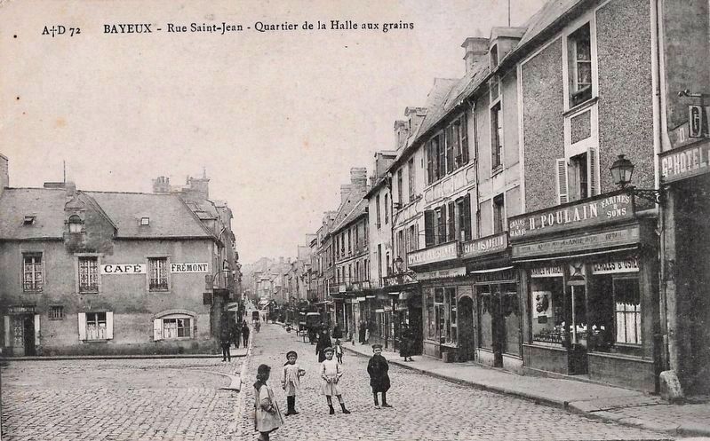
3. Rue Saint-Jean, looking west
This photo was taken from the grain market in front of the Halle des Grains (not visible here, but to the viewer’s left), and is looking west along the rue Saint-Jean. The marker location, not quite visible here, is less than 50 meters distant, on the left side of the street.

Regionally, it is in the North Atlantic Region, Europe, the European Union, Atlantic Europe, the Schengen Area, Western Europe, a coastal Mediterranean country, and the Western World. Historically, it finds itself in what was once a French colony and also the Roman Empire.
Other nearby markers. At least 8 other markers are within walking distance of this marker: Autour des Augustines (about 120 meters away, measured in a direct line); Le quartier des tanneurs et des teinturiers / Tanners and Dyers District (about 120 meters away); Le Quartier du Pont Saint-Jean (about 120 meters away); Smallest House in France (about 120 meters away); L’ancien moulin et la glacière industrielle / The Old Mill and Industrial Icehouse (about 120 meters away); Salome's Garden (about 150 meters away); Le tour des Augustines - rénové en septembre 2019 / Augustinian Tower - renovated in September 2019 (about 180 meters away); The Bayeux Tapestry (about 210 meters away). Touch for a list and map of all markers in Bayeux.
More about this marker. The caption on the upper right picture reads:
Décor de la tour de l'hôtel du Croissant
Scenery of the tower at the Hotel du Croissant (Crescent)
The caption on the lower right picture reads:
Le blason ayant donné son nom à l'hôtel du Croissant
The coat of arms gave the Hotel du Croissant its name.
Credits. This page was last revised on August 7, 2026. It was originally submitted on August 8, 2015, by Kevin W. of Stafford, Virginia. This page has been viewed 399 times since then and 20 times this year. Photos: 1, 2. submitted on August 8, 2015, by Kevin W. of Stafford, Virginia. 3. submitted on August 7, 2026.
