Near Odessa in Ector County, Texas — The American South (West South Central)
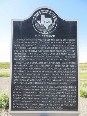
The Caprock
Photographed by Bill Kirchner, July 12, 2015
1. The Caprock Marker
Observed by Coronado's expedition, 1540-1541, provided shelter in storms, but delayed entrance of settlers to Staked Plains. Herds of stampeding cattle at times plunged over its edge. In the area, the Caprock blocked eastbound wagons, including some from California gold fields in 1850's. Because of scarce surface water, Staked Plains were too dry for farming or ranching until wells were drilled and windmills installed.
Ridges and canyons here hindered railroad building. In 1881 workmen earned $2.50 a day-highest wages ever paid until then on a Texas railroad job-at "Colt's Big Rock Cut" (the mile-wide, 17-ft. chasm visible here). A tragic accident with dynamite injured several of Colt's men and killed three.
this page online
Erected 1967 by State Historical Survey Committee. (Marker Number 5299.)
Topics and series. This historical marker is listed in these topic lists: Environment • Railroads & Streetcars. In addition, it is included in the Windmills series list. A significant historical year for this entry is 1881.
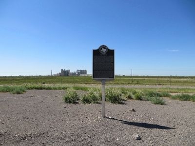
Location. 31° 45.272′ N, 102° 33.284′ W. Marker is near Odessa, Texas, in Ector County. It is on Interstate 20 at milepost 104, on the right when traveling east. Marker is in the eastbound weigh station. Touch for map. Marker is in this post office area: Odessa TX 79763, United States of America. Touch for directions.

Regionally, this marker is in West Texas. It is also in the American Southwest. Globally, it is in North America, a Gulf of Mexico state, the Western Hemisphere, the Western World, and the Anglosphere. Historically, it finds itself in what was once New Spain, the Comanchería, the Republic of Texas, and one of the Confederate States of America.
Photographed by Bill Kirchner, July 12, 2015
2. The Caprock Marker
Other nearby markers. At least 8 other markers are within 13 miles of this marker, measured as the crow flies: Penwell (approx. 3½ miles away); Odessa Meteor Crater (approx. 4½ miles away); Ector County Discovery Well (approx. 4.8 miles away); Well's Point (approx. 10.2 miles away); The Henderson House (approx. 12.3 miles away); Odessa (approx. 12½ miles away); Ector County Public Schools (approx. 12½ miles away); The Jackrabbit (approx. 12½ miles away). Touch for a list and map of all markers in Odessa.
Another marker is no longer nearby. Odessa Meteor Craters (was approx. 2.2 miles away but has been confirmed missing).
Photographed by Bill Kirchner, July 12, 2015
3. The Caprock Marker
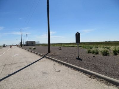
I-20 eastbound weigh station.
Credits. This page was last revised on June 16, 2016. It was originally submitted on August 9, 2015, by Bill Kirchner of Tucson, Arizona. This page has been viewed 1,500 times since then and 112 times this year. Photos: 1, 2, 3. submitted on August 9, 2015, by Bill Kirchner of Tucson, Arizona.
