East Stroudsburg in Monroe County, Pennsylvania — The American Northeast (Mid-Atlantic)
Fort Hyndshaw
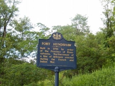
Photographed by Don Morfe, August 2, 2015
1. Fort Hyndshaw Marker
Erected 1949 by Pennsylvania Historical & Museum Commission.
Topics and series. This historical marker is listed in these topic lists: Forts and Castles • War, French and Indian. In addition, it is included in the Pennsylvania Historical and Museum Commission (PHMC) series list. A significant historical year for this entry is 1756.
Location. 41° 5.172′ N, 75° 0.454′ W. Marker is in East Stroudsburg, Pennsylvania, in Monroe County. It is at the intersection of Milford Road (US 209) and Community Drive on Milford Road (US 209). Touch for map. Marker is in this post office area: East Stroudsburg PA 18302, United States of America. Touch for directions.

Regionally, this marker is in the Pocono Mountains and in Greater Scranton and Wilkes-Barre. It is also in the American Northeast, in the Mid-Atlantic, in Appalachia, and specifically in Northern Appalachia. Globally, it is in North America, the Western Hemisphere, the Western World, and the Anglosphere. Historically, it finds
this page online
Other nearby markers. At least 8 other markers are within 5 miles of this marker, measured as the crow flies: Delaware Water Gap National Recreation Area (approx. 0.3 miles away); Village of Bushkill (approx. 0.3 miles away); a different marker also named Delaware Water Gap National Recreation Area (approx. 1.2 miles away); Dutch Settlers (approx. 1.6 miles away); Old Mine Road (approx. 1.8 miles away in New Jersey); Flatbrookville (approx. 2.4 miles away in New Jersey); a different marker also named Old Mine Road (approx. 3½ miles away in New Jersey); Marshalls Creek Explosion (approx. 4.3 miles away). Touch for a list and map of all markers in East Stroudsburg.
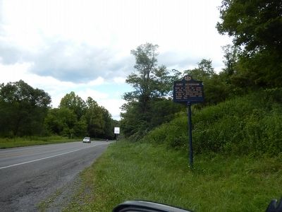
Photographed by Don Morfe, August 2, 2015
2. Fort Hyndshaw Marker
Credits. This page was last revised on June 16, 2016. It was originally submitted on August 10, 2015, by Don Morfe of Baltimore, Maryland. This page has been viewed 1,331 times since then and 90 times this year. Photos: 1, 2. submitted on August 10, 2015, by Don Morfe of Baltimore, Maryland. • Bill Pfingsten was the editor who published this page.
