
Creston in Union County, Iowa — The American Midwest (Upper Plains)
Graceland Cemetery
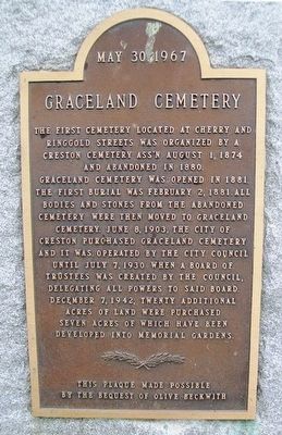
Photographed by William Fischer, Jr., August 1, 2015
1. Graceland Cemetery Marker
and abandoned in 1880.
Graceland Cemetery was opened in 1881. The first burial was February 2, 1881. All bodies and stones from the abandoned cemetery were then moved to Graceland Cemetery. June 8, 1903, the city of Creston purchased Graceland Cemetery and it was operated by the City Council until July 7, 1930 when a Board of Trustees was created by the Council, delegating all powers to said Board. December 7, 1942, twenty additional acres of land were purchased seven acres of which have been developed into memorial gardens.
[Dedicated] May 30, 1967
Erected 1967 by Graceland Cemetery and Olive Beckwith.
Topics. This historical marker is listed in this topic list: Cemeteries & Burial Sites. A significant historical month for this entry is February 1837.
Location. 41° 2.186′ N, 94° 21.361′ W. Marker is in Creston, Iowa, in Union County. It is on Cherry Street Road 1.2 miles south of Taylor Street (U.S. 34), on the left when traveling south. Touch for map. Marker is at or near this postal address: 1844 South Cherry Street Road, Creston IA 50801, United States of America. Touch for directions.

Regionally, this marker is in Southern Iowa. It is also in the American Midwest and in the Corn Belt. Globally, it is in North America, the Western Hemisphere, the Western World, and the Anglosphere. Historically, it finds itself in what was once the territory of the Mississippian Culture and also the Louisiana Purchase.
Other nearby markers. At least 8 other markers are within 2 miles of this marker, measured as the crow flies: Veterans Memorial (within shouting distance of this marker); Creston Freedom Rock Veterans Memorial (approx. 1.4 miles away); Phillips 66 Gasoline Station (approx. 1.4 miles
this page online
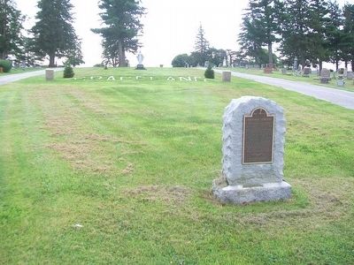
Photographed by William Fischer, Jr., August 1, 2015
2. Graceland Cemetery and Marker
Credits. This page was last revised on November 20, 2020. It was originally submitted on August 12, 2015, by William Fischer, Jr. of Reynoldsburg, Ohio. This page has been viewed 531 times since then and 55 times this year. Photos: 1, 2. submitted on August 12, 2015, by William Fischer, Jr. of Reynoldsburg, Ohio.
