Marker Logo HMdb.org THE HISTORICAL
MARKER DATABASE
“Bite-Size Bits of Local, National, and Global History”
Vidalia in Concordia Parish, Louisiana — The American South (West South Central)
 

Natchez


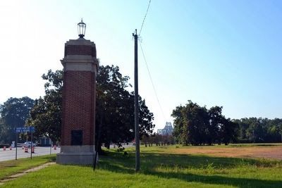
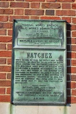
Natchez Marker image. Click for full size.
Photographed By Duane Hall, August 4, 2015
1. Natchez Marker
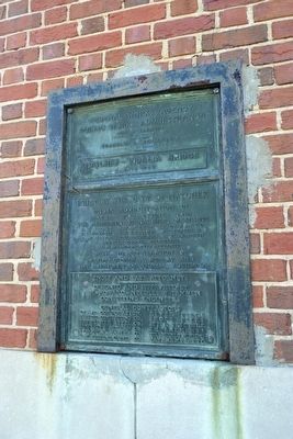
Inscription. Here passed, in 1543, De Soto’s men under Moscoso. In 1682 La Salle and De Tonti here visited the Natchez Indians. In 1716 Bienville here built Fort Rosalie and established a French settlement. In 1763 the fort was ceded to the English and renamed Ft. Panmure; in 1779 it passed to the Spaniards; in 1798 it was occupied by American troops. Chartered in 1803, the city of Natchez was from 1798 to 1802, and from 1817 to 1821 the capital of Mississippi.

In this, the 224th year since its founding, Natchez dedicates to the people the Natchez – Vidalia Bridge.
A.D. 1940
 
Erected 1940.
 
Topics. This historical marker is listed in these topic lists: Colonial EraForts and CastlesNative AmericansSettlements & Settlers. A significant historical year for this entry is 1543.
 
Location. 31° 34′ N, 91° 25.69′ W. Marker is in Vidalia, Louisiana, in Concordia Parish. Marker can be reached from the intersection of Carter Street (U.S. 84) and S. Spruce Street, on the right when traveling east. Touch for map. Marker is in this post office area: Vidalia LA 71373, United States of America. Touch for directions.
 
Other nearby markers. At least 8 other markers are within walking distance of this marker. Natchitoches - Natchez Road (within shouting distance of this marker); Post of Concord Established (approx. 0.4 miles away); Mississippi River
Paid Advertisement
Click on the ad for more information.
Please report objectionable advertising to the Editor.
Click or scan to see
this page online
(approx. half a mile away); James Bowie (approx. half a mile away); Great Mississippi River Flood of 1927 (approx. half a mile away); Relocation of Vidalia (approx. half a mile away); Sidney A. Murray, Jr., Hydroelectric Station (approx. half a mile away); Don José Vidal (approx. ¾ mile away). Touch for a list and map of all markers in Vidalia.
 
Additional commentary.
1. Identical Marker in Mississippi
An identical marker and pillar is located in Natchez, Mississippi near the east end of the Natchez-Vidalia Bridge.
    — Submitted August 14, 2015.
 
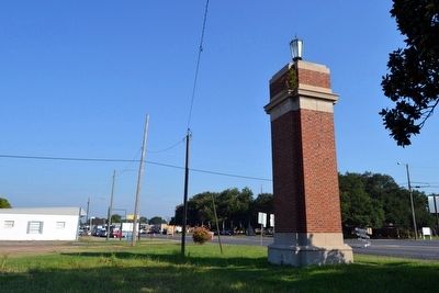
Natchez Marker image. Click for full size.
Photographed By Duane Hall, August 4, 2015
2. Natchez Marker
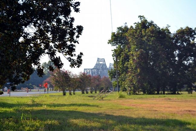
View to East Towards Natchez-Vidalia Bridge image. Click for full size.
Photographed By Duane Hall, August 4, 2015
3. View to East Towards Natchez-Vidalia Bridge
Bridge in center background
View to West Towards Vidalia image. Click for full size.
Photographed By Duane Hall, August 4, 2015
4. View to West Towards Vidalia
Natchez - Vidalia Bridge image. Click for full size.
Photographed By Duane Hall, August 4, 2015
5. Natchez - Vidalia Bridge
View to east from near marker location
Public Works Agency Plaque on Pillar image. Click for full size.
Photographed By Duane Hall, August 4, 2015
6. Public Works Agency Plaque on Pillar
 
 
Credits. This page was last revised on December 5, 2016. It was originally submitted on August 14, 2015, by Duane Hall of Abilene, Texas. This page has been viewed 500 times since then and 19 times this year. Photos:   1, 2, 3, 4, 5, 6. submitted on August 14, 2015, by Duane Hall of Abilene, Texas.
Share this page.  
Share on Tumblr
m=87168

CeraNet Cloud Computing sponsors the Historical Marker Database.
This website earns income from purchases you make after using our links to Amazon.com. We appreciate your support.
Paid Advertisement
Apr. 26, 2024