Natchez in Adams County, Mississippi — The American South (East South Central)
Bluff Park - Memorials and Louisiana Connections
Natchez Trails
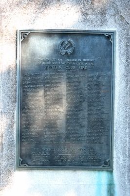
Inscription.
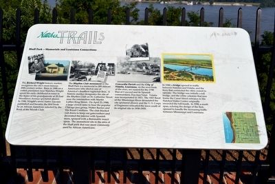
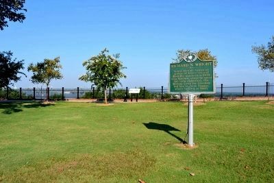
The Richard Wright historic marker recognizes the city’s most famous 20th-century writer. Born in 1908 on a cotton plantation near Natchez, Wright spent his early childhood in town in the home of his grandparents at 20 East Woodlawn Avenue (pictured above). In 1940, Wright’s novel Native Son was published and became the first book by an African American selected by the Book of the Month Club.
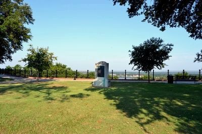
The Rhythm Club monument in the Bluff Park is a memorial to 209 African Americans who died in one of America’s deadliest nightclub fires. A historic marker designates the site of the Rhythm Club on St. Catherine Street near the intersection with Martin Luther King Street. On April 23, 1940, a large crowd came to hear the popular Chicago jazz group, Walter Barnes and His Royal Creolians. The club blocked exit doors to keep out gatecrashers and decorated the interior with Spanish moss, sprayed with a flammable insect spray. The monument sits in the area of the bluff park that was more commonly used by African Americans.
Concordia Parish and the City of Vidalia, Louisiana, on the west bank of the river, are named for the 1798 Post of Concord and its Spanish commandant, Don Jose Vidal. Vidalia was incorporated in 1811. The 1927 flood of the Mississippi River devastated the city (pictured above), and the U.S. Corps of Engineers relocated the town south of its original site in 1938-1939.
In 1940, a bridge opened to traffic between Natchez and Vidalia, and the ferry that connected the cities ceased to operate. The bridge was initially a toll bridge, and the white columns that now frame the Canal Street entrance to the Natchez Visitor Center originally encircled the toll booth. In 1990, a south span, echoing the design of the first, opened to handle the increasing traffic between Mississippi and Louisiana.
Topics and series. This historical marker is listed in these topic lists: Arts, Letters, Music • Disasters • Settlements & Settlers • Waterways & Vessels. In addition, it is included in the Mississippi - Natchez Trails series list. A significant historical month for this entry is April 1818.
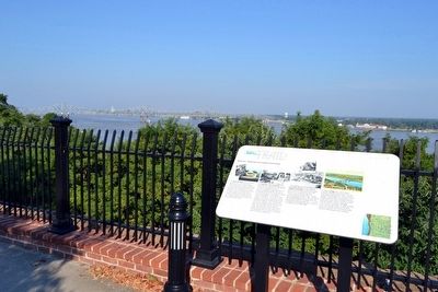
Location. 31° 33.701′ N, 91° 24.423′ W. Marker is in Natchez, Mississippi, in Adams County. Marker can be reached from S. Broadway Street south of Main Street, on the right when traveling south. Marker is located in Bluff Park along the pathway on the bluff line southwest of the bandstand. Touch for map. Marker is in this post office area: Natchez MS 39120, United States of America. Touch for directions.
Other nearby markers. At least 8 other markers are within walking distance of this marker. Richard N. Wright (a few steps from this marker); Natchez (within shouting distance of this marker);
Spanish Colonial Natchez (within shouting distance of this marker); Bluff Park - Playground for the City (within shouting distance of this marker); The Natchez Trace (about 400 feet away, measured in a direct line); Silver Street and Natchez Under-the-Hill (about 400 feet away); Bluff Park and South Broadway Street (about 400 feet away); Ealey Brothers (about 500 feet away). Touch for a list and map of all markers in Natchez.
Also see . . .
1. Richard Wright - Wikipedia entry. (Submitted on August 14, 2015.)
2. Rhythm Club Fire - Wikipedia entry. (Submitted on August 14, 2015.)
Credits. This page was last revised on June 16, 2016. It was originally submitted on August 14, 2015, by Duane Hall of Abilene, Texas. This page has been viewed 771 times since then and 42 times this year. Photos: 1, 2, 3, 4, 5. submitted on August 14, 2015, by Duane Hall of Abilene, Texas.
