Dauphin Island in Mobile County, Alabama — The American South (East South Central)
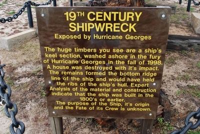
19th Century Shipwreck
Exposed by Hurricane Georges
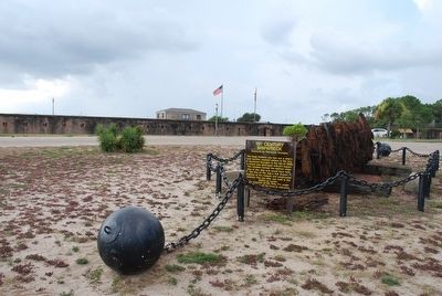
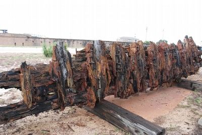
The huge timbers you see are a ship's keel section, washed ashore in the fury of Hurricane Georges in the fall of 1998. A house was destroyed with it's impact. The remains formed the bottom ridge line of the ship and would have held the ribs of the ship's hull. Expert Analysis of the material and construction indicate that the ship was built in the 1800's or earlier. The purpose of the Ship, it's origin and the Fate of its Crew is unknown.
Topics. This historical marker is listed in this topic list: Waterways & Vessels. A significant historical year for this entry is 1998.
Location. 30° 14.954′ N, 88° 4.582′ W. Marker is on Dauphin Island, Alabama, in Mobile County. Marker can be reached from Bienville Boulevard east of Albatross Street, on the right when traveling east. Located next to parking area at Fort Gaines. Touch for map. Marker is at or near this postal address: 51 Bienville Blvd, Dauphin Island AL 36528, United States of America. Touch for directions.
Other nearby markers. At least 8 other markers are within walking distance of this marker. British Occupation of Dauphin Island (within shouting distance of this marker); Fort Gaines (within shouting distance of this marker); Storm Clouds Gather (about 300 feet away, measured in a direct line); Energy from the Sands of Time (about 400 feet away); "To Be Blown To Kingdom Come" (about 400 feet away); Anchor From U.S.S. Hartford (about 400 feet away); "Save Your Garrison." (about 400 feet away); “Damn the Torpedoes!” (about 600 feet away). Touch for a list and map of all markers in Dauphin Island.
Credits. This page was last revised on June 16, 2016. It was originally submitted on August 15, 2015, by Brandon Fletcher of Chattanooga, Tennessee. This page has been viewed 627 times since then and 35 times this year. Photos: 1, 2, 3, 4. submitted on August 15, 2015, by Brandon Fletcher of Chattanooga, Tennessee. • Bernard Fisher was the editor who published this page.


