Plaquemine in Iberville Parish, Louisiana — The American South (West South Central)
Morrisonville
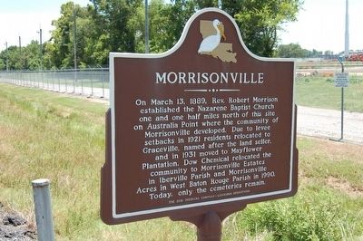
Photographed by Cajun Scrambler, July 31, 2015
1. Morrisonville Marker
On March 13, 1889, Rev. Robert Morrison established the Nazarene Baptist Church one and one half miles north of this site on Australia Point where the community of Morrisonville developed. Due to levee setbacks in 1921 residents relocated to Graceville, named after the land seller, and in 1931 moved to Mayflower Plantation. Dow Chemical relocated the community to Morrisonville Estates in Iberville Parish and Morrisonville Acres in West Baton Rouge Parish in 1990. Today, only the cemeteries remain.
Erected 2004 by The Dow Chemical Company - Louisiana Operations.
Topics. This historical marker is listed in these topic lists: African Americans • Cemeteries & Burial Sites • Industry & Commerce • Settlements & Settlers. A significant historical month for this entry is March 1300.
Location. 30° 19.405′ N, 91° 13.347′ W. Marker is in Plaquemine, Louisiana, in Iberville Parish. It is on Warren Road (State Highway 988) one mile south of South River Road, on the right when traveling south. Touch for map. Marker is in this post office area: Plaquemine LA 70764, United States of America. Touch for directions.

Regionally,
this page online
Other nearby markers. At least 8 other markers are within 3 miles of this marker, measured as the crow flies: Sardine Point (approx. ¾ mile away); Joyce S. Hebert (approx. 2.2 miles away); Gary J. Hebert Memorial Lockhouse (approx. 2.3 miles away); Bayou Plaquemine (approx. 2.3 miles away); a different marker also named Bayou Plaquemine (approx. 2.3 miles away); Old City Hall (approx. 2.3 miles away); Academy of Saint Basil (approx. 2.4 miles away); Plaquemine First United Methodist Church (approx. 2.4 miles away). Touch for a list and map
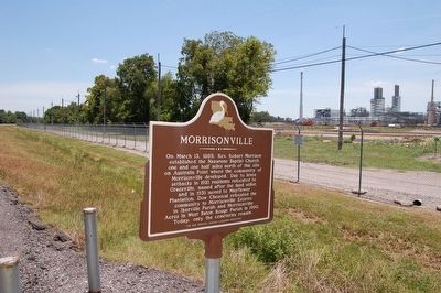
Photographed by Cajun Scrambler, July 31, 2015
2. Morrisonville Marker
Credits. This page was last revised on February 24, 2024. It was originally submitted on August 16, 2015. This page has been viewed 965 times since then and 56 times this year. Photos: 1, 2. submitted on August 16, 2015. • Bernard Fisher was the editor who published this page.
