Lewellen in Garden County, Nebraska — The American Midwest (Upper Plains)
Wagon Ruts
Photographed by Bill Coughlin, August 3, 2015
1. Wagon Ruts Marker
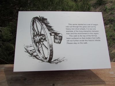
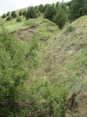
This ravine started as a set of wagon ruts cut through the grass and soil by heavy iron-shod wheels. It is but one example of the long interaction between man and the environment in this region.
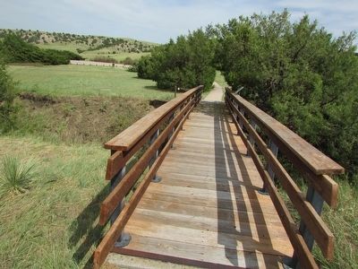
This walk to the top of the hill has been surfaced so that modern foot traffic will not further erode this historic hillside. Please stay on the trail.
Topics and series. This historical marker is listed in this topic list: Roads & Vehicles. In addition, it is included in the Oregon Trail series list.
Location. 41° 15.784′ N, 102° 6.892′ W. Marker is in Lewellen, Nebraska, in Garden County. It can be reached from U.S. 26, on the right when traveling south. Marker is located in the Windlass Hill section of Ash Hollow State Historical Park. Touch for map. Marker is in this post office area: Lewellen NE 69147, United States of America. Touch for directions.

Regionally, this marker is in the Nebraska Panhandle. It is also in the American Midwest, in the Corn Belt, on the prairies, on the Great Plains, and specifically on the High Plains. Globally, it is in North
this page online
Other nearby markers. At least 8 other markers are within 2 miles of this marker, measured as the crow flies: Wagons in the West (within shouting distance of this marker); Rough Going (within shouting distance of this marker); Oregon Trail (about 600 feet away, measured in a direct line); Descent of Windlass Hill (about 800 feet away); a different marker also named The Oregon Trail (approx. 0.2 miles away); a different marker also named Oregon Trail (approx. 0.3 miles away); Windlass Hill Pioneer Homestead (approx. 1½ miles away); School District 55 (approx. 1.6 miles away). Touch for a list and map of all markers in Lewellen.
More about this marker. The left side of the marker features a picture of a wagon wheel making a rut in the ground.
Photographed by Bill Coughlin, August 3, 2015
2. Wagon Ruts Marker
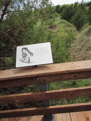
The ravine that resulted from the wagon ruts can be seen behind the marker.
Photographed by Bill Coughlin, August 3, 2015
3. Wagon Ruts Marker
Photographed by Bill Coughlin, August 3, 2015
4. Wagon Ruts Marker
Photographed by Bill Coughlin, August 3, 2015
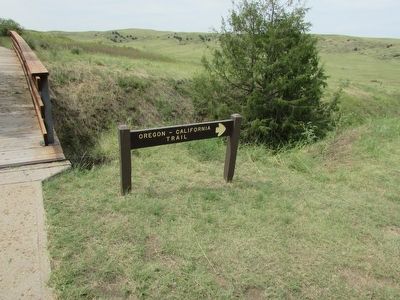
5. The Oregon - California Trail
Photographed by Bill Coughlin, August 3, 2015
6. Wagon Ruts
Credits. This page was last revised on December 21, 2024. It was originally submitted on August 17, 2015, by Bill Coughlin of Woodland Park, New Jersey. This page has been viewed 1,002 times since then and 70 times this year. Photos: 1, 2, 3, 4, 5, 6. submitted on August 17, 2015, by Bill Coughlin of Woodland Park, New Jersey.
