Ridgeland in Madison County, Mississippi — The American South (East South Central)
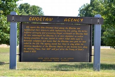
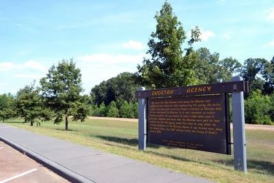
Choctaw Agency
Erected by National Park Service.
Topics and series. This historical marker is listed in these topic lists: Government & Politics • Native Americans. In addition, it is included in the Natchez Trace series list. A significant historical year for this entry is 1807.
Location. 32° 25.828′ N, 90° 9.199′ W. Marker is in Ridgeland, Mississippi, in Madison County. Marker can be reached from Natchez Trace Parkway (at milepost 100.7), half a mile west of Interstate 55, on the left when traveling east. Touch for map. Marker is in this post office area: Ridgeland MS 39157, United States of America. Touch for directions.
Other nearby markers. At least 8 other markers are within 3 miles of this marker, measured as the crow flies. Old Agency Road (approx. 0.2 miles away); Ridgeland (approx. 1.2 miles away); Tougaloo College (approx. 1.9 miles away); a different marker also named Tougaloo College (approx. 2.1 miles away); a different marker also named Old Agency Road (approx. 2.7 miles away); World War II Airfield Hangars (approx. 2.9 miles away); Strawberry Patch House (approx. 3 miles away); Madison (approx. 3 miles away). Touch for a list and map of all markers in Ridgeland.
Also see . . .
1. Natchez Trace Parkway. Official National Park Service website. (Submitted on August 18, 2015.)
2. Silas Dinsmoor - Wikipedia entry. (Submitted on August 18, 2015.)
Credits. This page was last revised on June 16, 2016. It was originally submitted on August 18, 2015, by Duane Hall of Abilene, Texas. This page has been viewed 527 times since then and 32 times this year. Photos: 1, 2, 3. submitted on August 18, 2015, by Duane Hall of Abilene, Texas.


