Kennesaw in Cobb County, Georgia — The American South (South Atlantic)
The Dead Angle
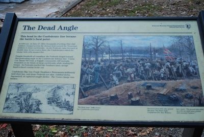
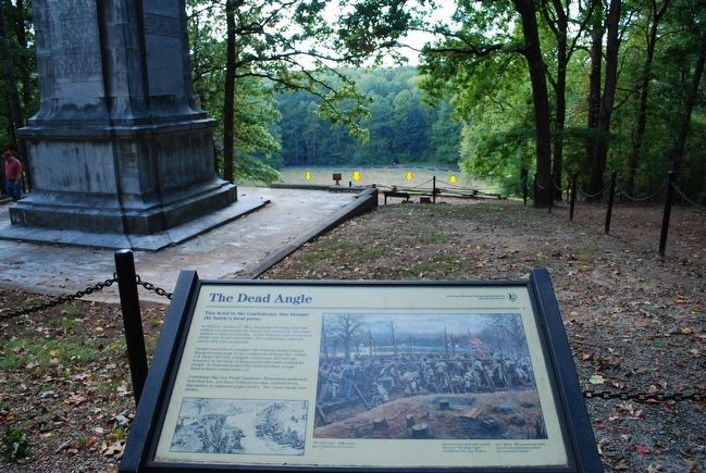
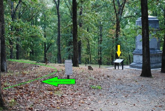
This bend in the Confederate line became the battle's focal point.
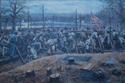
At 9 a.m. on June 27, 1864, thousands of yelling, blue-clad soldiers charged across the distant field toward the Tennessee soldiers in these earthworks. As the Federals came forward at double time in successive lines, the Confederates raked the enemy with rifle-musket fire.
Despite hundreds of casualties, the Federals surged toward this protruding angle in the Confederate defense line. Union Col. Daniel McCook, a brigade commander, fell mortally wounded on the brink of these earthworks while leading his troops. As Federals reached the Southern line, savage hand-to-hand combat broke out.
Confederate Maj. Gen. Frank Cheatham's Tennesseans stubbornly held their line, and those Federals not shot, clubbed down, bayoneted, or captured sought shelter. The Union charge was broken.
Captions:
"The Dead Angle" (left) drawn by a Confederate participant.
Survivors from both sides named this area “The Dead Angle.” Confederate Pvt. Sam Watkins later wrote, “The ground was piled up with one solid mass of dead and wounded Yankees.”
Erected by Kennesaw Mountain National Battlefield Park, National Park Service.
Topics. This historical marker is listed in this topic list: War, US Civil. A significant historical month for this entry is June 1876.
Location. 33° 56.081′ N, 84° 35.905′ W. Marker is in Kennesaw, Georgia, in Cobb County. Marker can be reached from Cheatam Hill Drive SW, 0.6 miles south of Dallas Road SW (Georgia Route 120), on the right when traveling south. The marker is located in Kennesaw Mountain National Battlefield Park. Touch for map. Marker is in this post office area: Marietta GA 30064, United States of America. Touch for directions.
Other nearby markers. At least 8 other markers are within walking distance of this marker. The Assault Falters (a few steps from this marker); Illinois Monument (within shouting distance of this marker); Monument to the Fallen (within shouting distance of this marker); Field Fortifications (about 600 feet away, measured in a direct line); Camouflaged Cannons (about 700 feet away); Climax at Cheatham Hill (about 700 feet away); This Marks the Starting Point (approx. 0.2 miles away); They Who Fell Here (approx. 0.2 miles away). Touch for a list and map of all markers in Kennesaw.
Also see . . . Kennesaw Mountain National Battlefield Park. National Park Service (Submitted on August 20, 2015.)
Photographed By Brandon Fletcher, October 11, 2008
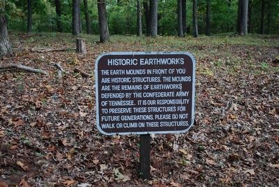
6. Historic Earthworks
The earth mounds in front of you are historic structures. The mounds are the remains of earthworks defended by the Confederate Army of Tennessee. It is our responsibility to preserve these structures for future generations. Please do not walk or climb on these structures.
Credits. This page was last revised on May 28, 2020. It was originally submitted on August 19, 2015, by Brandon Fletcher of Chattanooga, Tennessee. This page has been viewed 1,049 times since then and 54 times this year. Photos: 1, 2, 3, 4, 5, 6. submitted on August 19, 2015, by Brandon Fletcher of Chattanooga, Tennessee. • Bernard Fisher was the editor who published this page.
