Near Galveston in Galveston County, Texas — The American South (West South Central)
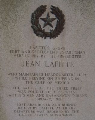
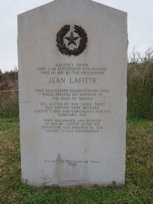
Lafitte's Grove
Erected 1936 by State of Texas Highway Department. (Marker Number 7509.)
Topics and series. This historical marker is listed in these topic lists: Forts and Castles • Settlements & Settlers • Wars, US Indian. In addition, it is included in the Texas 1936 Centennial Markers and Monuments series list. A significant historical year for this entry is 1817.
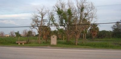
Location. 29° 12.769′ N, 94° 56.128′ W. Marker is near Galveston, Texas, in Galveston County. Marker is on Stewart Road, ¼ mile east of 12-Mile Road, on the right when traveling east. Touch for map. Marker is in this post office area: Galveston TX 77550, United States of America. Touch for directions.
Other nearby markers. At least 8 other markers are within 8 miles of this marker, measured as the crow flies. West Galveston Island (approx. 1.4 miles away); Karankawa Campsite (approx. 3.3 miles away); Site of Magnolia Grove Cemetery (approx. 6.2 miles away); Galveston "News", C.S.A. (approx. 6½ miles away); The Galveston Daily News (approx. 6½ miles away); Campbell's Bayou (approx. 6.6 miles away); Original Site of St. Mary's Orphan Asylum (approx. 7.1 miles away); Rosewood Cemetery (approx. 7.4 miles away). Touch for a list and map of all markers in Galveston.
Additional commentary.
1. Amusement Park at Lafitte's Grove
In 1885, the Galveston Volunteer Fire Department hosted a picnic for the New Orleans Volunteer Fire Department at Lafitte's Grove. In 1897, an amusement park complete with race track, shooting gallery, archery range, picnic area, and surf bathing was located at Lafitte's Grove. The "Little Suzie", a steam locomotive operated by the Galveston and Western Railway Company, pulled a train from Galveston to Lafitte's Grove. The train also served the Nottingham Lace Curtain Factory about a mile east of Lafitte's Grove until it closed in 1896. In 1932, Maco Stewart, Sr. donated a parcel of land at Lafitte's Grove to the Sidney Sherman Chapter of the Daughters of the Republic of Texas for use as a picnic park. Note To Editor only visible by Contributor and editor
— Submitted February 15, 2013, by Jerry D. Penn of Springfield, Virginia.
Additional keywords. Pirates

Photographed By Richard Denney, December 31, 2013
5. Lafitte's Cove Nature Preserve
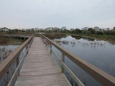
Lafitte's Cove Nature Preserve is located on Eckert Drive, in the subdivision across from the marker, and adjacent to Eckert Bayou. The preserve provides a look at what the area might have looked like in Lafitte's day, and before when this was home to the Karankawas.
Credits. This page was last revised on September 14, 2020. It was originally submitted on May 7, 2010, by Gregory Walker of La Grange, Texas. This page has been viewed 3,128 times since then and 54 times this year. Last updated on August 26, 2015, by Jerry D. Penn of Springfield, Virginia. Photos: 1. submitted on May 7, 2010, by Gregory Walker of La Grange, Texas. 2. submitted on January 3, 2014, by Richard Denney of Austin, Texas. 3. submitted on May 7, 2010, by Gregory Walker of La Grange, Texas. 4, 5. submitted on January 3, 2014, by Richard Denney of Austin, Texas. • J. J. Prats was the editor who published this page.


