Frogmore in Beaufort County, South Carolina — The American South (South Atlantic)
The Great Sea Island Storm
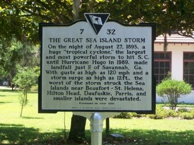
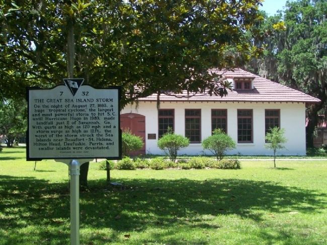
On the night of August 27, 1893, a huge "tropical cyclone," the largest and most powerful storm to hit S.C. until Hurricane Hugo in 1989, made landfall just E of Savannah, Ga. With gusts as high as 120 mph and a storm surge as 12 ft., the worst of the storm struck the Sea Islands near Beaufort - St. Helena, Hilton Head, Daufuskie, Parris and smaller islands were devastated.
(Continued on other side)
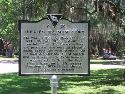
(Reverse text )
The storm killed more than 2,000 and left more than 70,000 destitute in coastal S.C. and Ga. Losses in lives and property were most catastrophic among blacks who were former slaves or their descendants. Clara Barton and the American Red Cross launched a massive relief effort, the first after a hurricane in U.S. history. Donations in 1893-94 fed, clothed, and sheltered thousands.
Erected 2008 by Beaufort County Historical Society. (Marker Number 7-32.)
Topics and series. This historical marker is listed in these topic lists: African Americans • Disasters • Notable Events • Notable Places. In addition, it is included in the Clara Barton, and the South Carolina, Beaufort County Historical Society series lists. A significant historical year for this entry is 1893.
Location. 32° 23.295′ N, 80° 34.605′ W. Marker is in Frogmore, South Carolina, in Beaufort County. Marker is on Dr. Martin Luther King Drive (State Highway S-7-45), on the right when traveling south. Marker is located at the Penn School site at the Penn Center. Touch for map. Marker is in this post office area: Saint Helena Island SC 29920, United States of America. Touch for directions.
Other nearby markers. At least 8 other markers are within 7 miles of this marker, measured as the crow flies. In Honor Of Edith M. Dabbs and James McBride Dabbs (here, next to this marker); Penn School (within shouting distance of this marker); Chapel of Ease (approx. 0.9 miles away); Tidalholm (approx. 6.1 miles away); Emancipation Day / Camp Saxton Site (approx. 6.1 miles away); Plane Crash Memorial (approx. 6.2 miles away); Capt. Brodstrom Marker U.S.M.C. (approx. 6.2 miles away); Brigadier General Stephen Elliott CSA (approx. 6.2 miles away).
Credits. This page was last revised on October 18, 2020. It was originally submitted on July 3, 2008, by Mike Stroud of Bluffton, South Carolina. This page has been viewed 2,820 times since then and 27 times this year. Photos: 1, 2, 3. submitted on July 3, 2008, by Mike Stroud of Bluffton, South Carolina. • Christopher Busta-Peck was the editor who published this page.


