Davis Creek in Modoc County, California — The American West (Pacific Coastal)
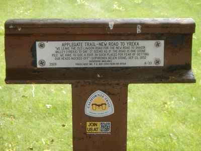
Applegate Trail - New Road to Yreka
Guidebook available
Trails West Inc., P.O. Box 12045, Reno, NV 89510
Erected 2009 by Trails West Inc. (Marker Number A-33.)
Topics and series. This historical marker is listed in these topic lists: Roads & Vehicles • Settlements & Settlers. In addition, it is included in the Applegate Trail, the California Trail, and the Trails West Inc. series lists. A significant historical date for this entry is September 13, 1852.
Location. 41° 43.998′ N, 120° 22.543′ W. Marker is in Davis Creek, California, in Modoc County. Marker is on Westside Road (County Route 48) near U.S. 395, on the left when traveling west. Touch for map. Marker is in this post office area: Davis Creek CA 96108, United States of America. Touch for directions.
Other nearby markers. At least 8 other markers are within 10 miles of this marker, measured as the crow flies. Applegate Trail - Davis Creek (a few steps from this marker); Applegate Trail - Descent to Goose Lake (approx. 7˝ miles away); South Road - McGinty Creek (approx. 8.1 miles away); Applegate Trail - Through the Forest (approx. 8.7 miles away); Applegate Trail - Descent to Lassen Creek (approx. 9 miles away); Chimney Rock (approx. 9.8 miles away); Applegate Trail - Fandango Pass Descent (approx. 9.9 miles away); The Applegate-Lassen Trail (approx. 10 miles away). Touch for a list and map of all markers in Davis Creek.
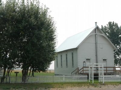
More about this marker. This marker is located at the Davis Creek Community Church.
Credits. This page was last revised on June 16, 2016. It was originally submitted on August 29, 2015, by Barry Swackhamer of Brentwood, California. This page has been viewed 413 times since then and 8 times this year. Photos: 1, 2. submitted on August 29, 2015, by Barry Swackhamer of Brentwood, California.

