Near Pinehurst in Jackson County, Oregon — The American West (Northwest)
The Applegate Trail
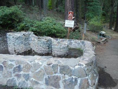
Tub Springs
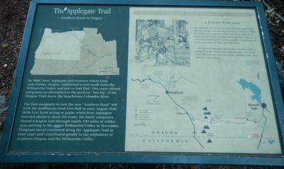
In 1846, Jesse Applegate and fourteen others from near Dallas, Oregon, established a trail south from the Willamette Valley and east to Fort Hall. This route offered emigrants an alternative to the perilous "last leg" over the Oregon Trail down the treacherous Colombia River.
The first emigrants to trek the new "Southern Route" left with trailblazers from Fort Hall in early August 1846. With Levi Scott acting as guide, while Jesse Applegate traveled ahead to mark the route, the hardy emigrants blazed a wagon trail through nearly 500 miles of wilderness arriving in the upper Willamette Valley in November. Emigrants travel continued along the Applegate Trail in later years and contributed greatly to the settlement of southern Oregon and the Willamette Valley.
The Applegate Trail passed less than 100 yards up hill from this site through land described by Virgil K. Pringle in 1846 as "good but very rough and broken." Ellen Burt made the journey in 1853 and "walked all day in mud." Then as now, with streams located in deep ravines, Tub Springs was a welcome source of easily accessible water.
...15 miles over hilly stony roads through very heavy timber to mountain spring. Good wood, water and grass. Saw several bears, killed two deer. It is very cloudy, sprinkled a little. First rain since 14th of June. - Wellborn Beeson, August 27, 1853
Topics and series. This historical marker is listed in these topic lists: Roads & Vehicles • Settlements & Settlers. In addition, it is included in the Applegate Trail series list. A significant historical date for this entry is August 27, 1853.
Location. 42° 6.948′ N, 122° 26.532′ W. Marker is near Pinehurst, Oregon, in Jackson County. Marker can be reached from Green Springs Highway (Oregon Route 66), on the right when traveling west. Touch for map. Marker is at or near this postal address: 12705-12727 Green Springs Highway, Ashland OR 97520, United States of America. Touch for directions.
Other nearby markers. At least 8 other markers are within 8 miles of this marker, measured as the crow flies. Crossing the Siskiyous (a few steps from this marker); Tub Springs Sugar Pine (a few steps from this marker); Historic Applegate Trail (within shouting distance of this marker); Greensprings (approx. 1.2 miles away); Keene Creek Wagon Slide (approx. 2 miles away); Historic Applegate Trail 1846 - 1869 (approx. 2 miles away); Route of Historic Applegate Trail (approx. 6.6 miles away); Siskiyou Mountain Wagon Road (approx. 8.1 miles away). Touch for a list and map of all markers in Pinehurst.
Credits. This page was last revised on October 14, 2016. It was originally submitted on September 1, 2015, by Barry Swackhamer of Brentwood, California. This page has been viewed 366 times since then and 13 times this year. Photos: 1, 2. submitted on September 1, 2015, by Barry Swackhamer of Brentwood, California.

