Grand Teton National Park in Teton County, Wyoming — The American West (Mountains)
Shrinking Teton Glaciers
Grand Teton National Park
Photographed by Bill Coughlin, July 26, 2015
1. Shrinking Teton Glaciers Marker
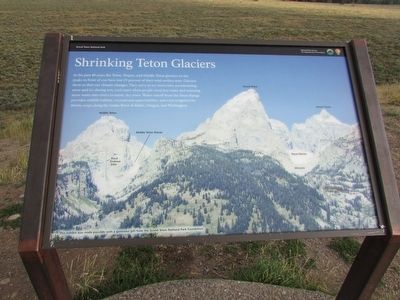
In the past 40 years the Teton, Teepee, and Middle Teton glaciers on the peaks in front of you have lost 25 percent of their total surface area. Glaciers show us that our climate changes. They serve as icy reservoirs, accumulating snow and ice during the wet, cool years when people need less water and releasing more water into rivers in warm, dry years. Water runoff from the Teton Range provides wildlife habitat, recreational opportunities, and even irrigation for thirsty crops along the Snake River in Idaho, Oregon, and Washington.
Erected by National Park Service.
Topics. This historical marker is listed in this topic list: Natural Features.
Location. 43° 41.467′ N, 110° 40.404′ W. Marker is in Grand Teton National Park, Wyoming, in Teton County. It can be reached from U.S. 26, on the right when traveling south. Marker is located in Grand Teton National Park at the Glacier View Turnout. Touch for map. Marker is in this post office area: Moose WY 83012, United States of America. Touch for directions.

Regionally, this marker is in the Jackson Hole Area and in Greater
this page online
Other nearby markers. At least 8 other markers are within 3 miles of this marker, measured as the crow flies: A Once Vibrant Community (approx. 1.8 miles away); Foundations of a Community (approx. 2.7 miles away); Geologic Drama (approx. 2.7 miles away); Making it Last (approx. 2.9 miles away); Staying Cool (approx. 2.9 miles away); Water Filter (approx. 2.9 miles away); “Mean and Menor” (approx. 2.9 miles away); Menor’s Ferry (approx. 3 miles away). Touch for a list and map of all markers in Grand Teton National Park.
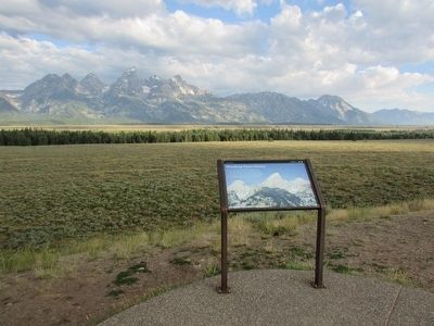
More about this marker. The background of the marker contains a photograph of the view from the marker. Middle Teton, Grand Teton, Mount Owen, Black Diabase Dike, Middle Teton Glacier, Teton Glacier, and Moraine are marked in the photo.
Photographed by Bill Coughlin, July 26, 2015
2. Shrinking Teton Glaciers Marker
Photographed by Bill Coughlin, July 26, 2015
3. Marker in Grand Teton National Park
Photographed by Bill Coughlin, July 26, 2015
4. Shrinking Teton Glaciers Marker
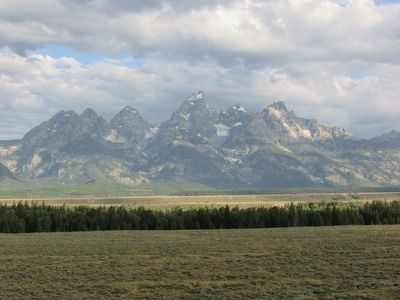
Photographed by Bill Coughlin, July 26, 2015
5. Teton Glaciers Seen from the Marker
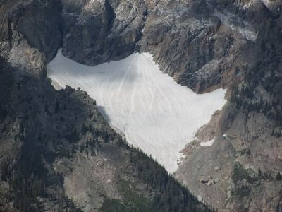
Photographed by Bill Coughlin, July 28, 2015
6. Glacier on Mount Moran
Credits. This page was last revised on November 21, 2024. It was originally submitted on September 2, 2015, by Bill Coughlin of Woodland Park, New Jersey. This page has been viewed 1,229 times since then and 91 times this year. Photos: 1, 2, 3, 4, 5. submitted on September 2, 2015, by Bill Coughlin of Woodland Park, New Jersey. 6. submitted on September 5, 2015, by Bill Coughlin of Woodland Park, New Jersey.
