Shoshoni in Fremont County, Wyoming — The American West (Mountains)
Geology of the Wind River Canyon
Photographed by Bill Coughlin, August 2, 2015
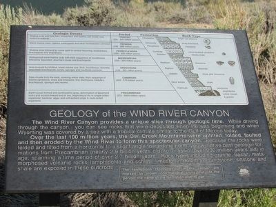
1. Geology of the Wind River Canyon Marker
The Wind River Canyon provides a unique slice through geologic time. While driving through the canyon, you can see rocks that were deposited when life was beginning and when Wyoming was covered by a sea with a tropical climate similar to the Gulf of Mexico today.
Over the last 100 million years, the Owl Creek Mountains were uplifted, folded, faulted and then eroded by the Wind River to form this spectacular canyon. Because the rocks were folded and tilted from a horizontal to a slight angle toward the north, you will drive past geologic formations from Precambrian (nearly 2.9 billion years old) to Triassic (over 200 million years old) in age, spanning a time period of over 2.7 billion years. Rock types including granite, basalt, metamorphosed volcanic rocks (amphibolite and schist), limestone, dolomite, sandstone, siltstone and shale are exposed in these outcrops.
Topics. This historical marker is listed in this topic list: Natural Features.
Location. 43° 24.671′ N, 108° 10.469′ W. Marker is in Shoshoni, Wyoming, in Fremont County. It is on U.S. 20, on the
this page online

Regionally, this marker is in Wind River Country. It is also in the American Mountain West. Globally, it is in North America, the Rocky Mountains, the Western Hemisphere, the Western World, and the Anglosphere.
Other nearby markers. At least 8 other markers are within 13 miles of this marker, measured as the crow flies: Boysen Dam and Reservoir Today (here, next to this marker); Wind River Canyon (a few steps from this marker); “Wild Sheep and Wild Fire” (a few steps from this marker); Site of Original Boysen Dam (approx. 2.1 miles away); Boysen's Historic Dam (approx. 2.2 miles away); Wedding of the Waters (approx. 12.4 miles away); a different marker also named Wedding of the Waters (approx. 12½ miles away); Shoshoni (approx. 12.7 miles away). Touch for a list and map of all markers in Shoshoni.
More about this marker. A chart at the top of the marker lists Geologic Events, Periods, Formations and Rock Types.
Photographed by Bill Coughlin, August 2, 2015
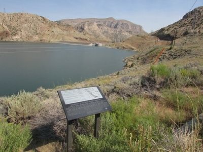
2. Geology of the Wind River Canyon Marker
Photographed by Bill Coughlin, August 2, 2015
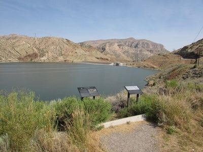
3. Markers at the Wind River Canyon
Several markers can be found at this site. The Geology of the Wind River marker is seen here on the right.
Photographed by Bill Coughlin, August 2, 2015
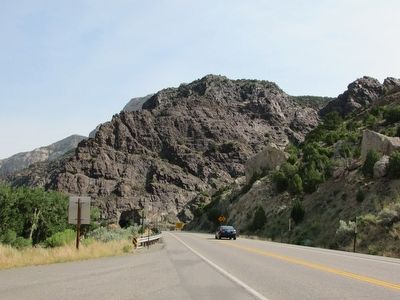
4. Wind River Canyon
Many of the layers mentioned on the marker can be seen on the rock face in the photo.
Credits. This page was last revised on June 16, 2016. It was originally submitted on September 3, 2015, by Bill Coughlin of Woodland Park, New Jersey. This page has been viewed 1,307 times since then and 56 times this year. Photos: 1, 2, 3, 4. submitted on September 3, 2015, by Bill Coughlin of Woodland Park, New Jersey.
