DeKalb County
[Side A]
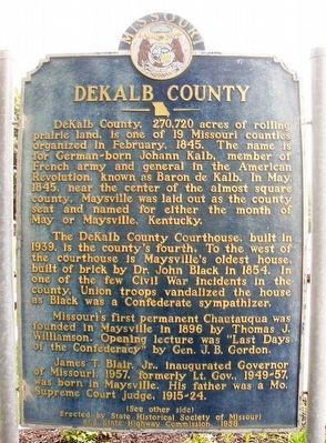
DeKalb County, 270,720 acres of rolling prairie land, is one of 19 Missouri counties organized in February, 1845. The name is for German-born Johann Kalb, member of the French army and general in the American Revolution, known as Baron de Kalb. In May, 1845, near the center of the almost square county, Maysville was laid out as the county seat and named for either the month of May or Maysville, Kentucky.
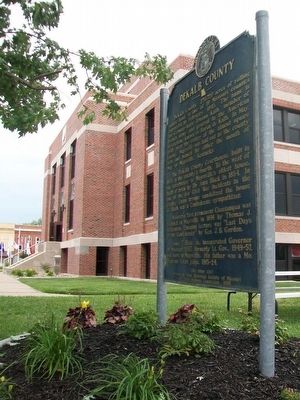
The DeKalb County Courthouse, built in 1939, is the county's fourth. To the west of the courthouse is Maysville's oldest house, built of brick by Dr. John Black in 1854. In one of the few Civil War incidents in the county, Union troops vandalized the house as Black was a Confederate sympathizer.
Missouri's first permanent Chautauqua was founded in Maysville in 1896 by Thomas J. Williamson. Opening lecture was "Last Days of the Confederacy" by Gen. J. B. Gordon.
James T. Blair, Jr., inaugurated Governor of Missouri, 1957, formerly Lt. Gov., 1949-57, was born in Maysville. His father was a Mo. Supreme Court judge, 1915-24.
(See other side)
[Side B]
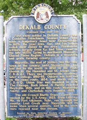
(Continued from other side)
First white settler in DeKalb County was a Canadian Frenchman, Samuel Vesser, who made a temporary home near Stewartsville in 1824, the year Iowa, Sac, and Fox tribes ceded their claims to the area. Permanent
Maysville, the seat of justice, was the only town in the county until Stewartsville was laid out to the south in 1858 on the route chosen by the Hannibal and St. Joseph (now C. B. & Q.). There was Stewartsville Academy, later a college, 1860-85. Osborn was laid out on the same route, 1854, and north on the C. B. & Q., Union Star was founded in 1879. The Chicago, Rock Island, & Pacific reached Maysville, 1886, and on this route Weatherby, Amity, and Clarksdale were founded, 1885.
The old Council Bluffs Trace, a post road opened by the U.S. Army, 1823, from Liberty, Mo., to Fort Atkinson, Nebr., ran through the county. Lost Creek near Maysville got its name when several soldiers, lost in the snow, were rescued near this stream.
Erected 1958 by State Historical Society of Missouri and State Highway Commission.
Topics and series. This historical marker is listed in these topic lists: Education • Railroads & Streetcars • Roads & Vehicles • Settlements & Settlers. In addition, it is included in the Chicago Rock Island & Pacific Railway, and the Missouri, The State Historical Society of series lists. A significant historical month for this entry is February 1845.
Location.
Other nearby markers. At least 8 other markers are within 13 miles of this marker, measured as the crow flies. DeKalb County Veterans Memorial (within shouting distance of this marker); 1st Annual St. Patrick's Day Parade (approx. 12.1 miles away); Herbert Clark Hoover (approx. 12.1 miles away); John T. Walker (approx. 12.1 miles away); Lee Purcell / Michael Douglas (approx. 12.1 miles away); Jesse James (approx. 12.2 miles away); Cameron Railroads (approx. 12.2 miles away); Abraham Lincoln / John Wilkes Booth (approx. 12.3 miles away).
Also see . . . DeKalb County, Missouri. Wikipedia entry (Submitted on January 16, 2022, by Larry Gertner of New York, New York.)

University of Missouri Digital Library website entry
Click for more information.
Credits. This page was last revised on January 30, 2022. It was originally submitted on September 3, 2015, by William Fischer, Jr. of Scranton, Pennsylvania. This page has been viewed 665 times since then and 35 times this year. Photos: 1, 2, 3. submitted on September 3, 2015, by William Fischer, Jr. of Scranton, Pennsylvania.

