Shoshoni in Fremont County, Wyoming — The American West (Mountains)
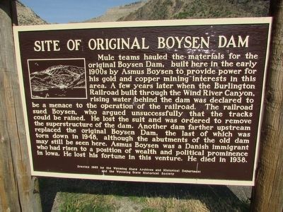
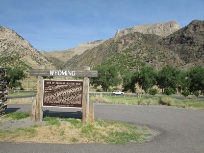
Site of Original Boysen Dam
Wyoming
Mule teams hauled the materials for the original Boysen Dam, built here in the early 1900s by Asmus Boysen to provide power for his gold and copper mining interests in this area. A few years later when the Burlington Railroad built through the Wind River Canyon, rising water behind the dam was declared to be a menace to the operation of the railroad. The railroad sued Boysen, who argued unsuccessfully that the tracks could be raised. He lost the suit and was ordered to remove the superstructure of the dam. Another dam farther upstream replaced the original Boysen Dam, the last of which was torn down in 1948, although the abutments of the old dam may still be seen here. Asmus Boysen was a Danish immigrant who had risen to a position of wealth and political prominence in Iowa. He lost his fortune in this venture. He died in 1938.
Erected 1965 by Wyoming State Archives and Historical Department and the Wyoming State Historical Society.
Topics. This historical marker is listed in this topic list: Man-Made Features.
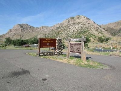
Location. 43° 26.471′ N, 108° 10.279′ W. Marker is in Shoshoni, Wyoming, in Fremont County. Marker is at the intersection of U.S. 20 and Lower Wind River Road, on the right when traveling south on U.S. 20. Marker is located at the entrance to Boysen State Park. Touch for map. Marker is in this post office area: Shoshoni WY 82649, United States of America. Touch for directions.
Other nearby markers. At least 8 other markers are within 15 miles of this marker, measured as the crow flies. Boysen's Historic Dam (about 700 feet away, measured in a direct line); Geology of the Wind River Canyon (approx. 2.1 miles away); Boysen Dam and Reservoir Today (approx. 2.1 miles away); Wind River Canyon (approx. 2.1 miles away); “Wild Sheep and Wild Fire” (approx. 2.1 miles away); Wedding of the Waters (approx. 10.4 miles away); a different marker also named Wedding of the Waters (approx. 10˝ miles away); World's Largest Mineral Hot Springs (approx. 14.4 miles away). Touch for a list and map of all markers in Shoshoni.
Credits. This page was last revised on June 16, 2016. It was originally submitted on September 3, 2015, by Bill Coughlin of Woodland Park, New Jersey. This page has been viewed 529 times since then and 28 times this year. Photos: 1, 2, 3. submitted on September 3, 2015, by Bill Coughlin of Woodland Park, New Jersey.


