
Grand Teton National Park in Teton County, Wyoming — The American West (Mountains)
Mount Moran
Grand Teton National Park
Photographed by Bill Coughlin, July 25, 2015
1. Mount Moran Marker
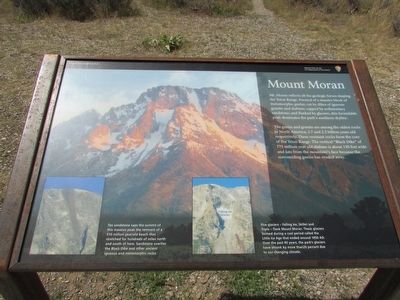
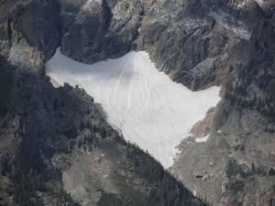
Mt. Moran reflects all the geologic forces shaping the Teton Range. Formed of a massive block of metamorphic gneiss; cut by dikes of igneous granite and diabase; capped by sedimentary sandstone; and flanked by glaciers, this formidable peak dominates the park’s northern skyline.
The gneiss and granite are among the oldest rocks in North America, 2.7 and 2.5 billion years old respectively. These resistant rocks form the core of the Teton Range. The vertical “Black Dike” of 775 million year old diabase is about 150 feet wide and juts from the mountain’s face because the surrounding gneiss has eroded away.
Erected by National Park Service.
Topics. This historical marker is listed in this topic list: Natural Features.
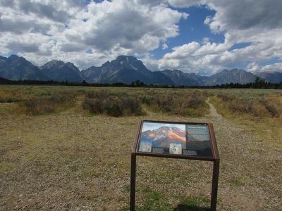
Location. 43° 48.205′ N, 110° 38.494′ W. Marker is in Grand Teton National Park, Wyoming, in Teton County. It is on Teton Park Road, on the right when traveling south. Marker is located in the Mount Moran Turnout in Grand Teton National Park. Touch for map. Marker is in this post office area: Moran WY 83013, United States of America. Touch for directions.

Regionally,
this page online
Other nearby markers. At least 8 other markers are within 5 miles of this marker, measured as the crow flies: Potholes (approx. 0.7 miles away); Teton Fault (approx. 2.8 miles away); Tetons Inspiring Creativity (approx. 3½ miles away); Capturing Nature in a Box (approx. 3½ miles away); Meandering Snake (approx. 3½ miles away); The Cathedral Group (approx. 3.7 miles away); a different marker also named The Cathedral Group (approx. 3.7 miles away); Cascade Canyon (approx. 4.1 miles away). Touch for a list and map of all markers in Grand Teton National Park.
More about this marker. The background of the marker features a photo of Mount Moran. There are two photographs at the bottom of the marker. One depicts the top of the mountain and has a caption of “Tan sandstone caps the summit of this massive peak the remnant of a 510 million year-old beach that stretched for hundreds of miles north and south
Photographed by Bill Coughlin, July 25, 2015
2. Mount Moran Marker
Photographed by Bill Coughlin, July 25, 2015
3. Marker in Grand Teton National Park
Photographed by Bill Coughlin, July 25, 2015
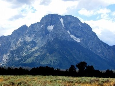
4. Mount Moran seen from the Marker
Photographed by Bill Coughlin, July 25, 2015
5. Glacier atop Mount Moran
Credits. This page was last revised on November 21, 2024. It was originally submitted on September 5, 2015, by Bill Coughlin of Woodland Park, New Jersey. This page has been viewed 1,240 times since then and 77 times this year. Photos: 1, 2, 3, 4, 5. submitted on September 5, 2015, by Bill Coughlin of Woodland Park, New Jersey.
