Marker Logo HMdb.org THE HISTORICAL
MARKER DATABASE
“Bite-Size Bits of Local, National, and Global History”
Pittsburg in Laurel County, Kentucky — The American South (East South Central)
 

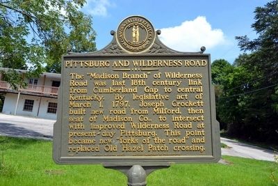
Pittsburg and Wilderness Road


Pittsburg and Wilderness Road Marker image. Click for full size.
Photographed By Duane Hall, August 9, 2015
1. Pittsburg and Wilderness Road Marker
Inscription. The “Madison Branch” of Wilderness Road was last 18th century link from Cumberland Gap to central Kentucky. By legislative act of March 1, 1797, Joseph Crockett built new road from Milford, then seat of Madison Co., to intersect with improved Wilderness Road at present-day Pittsburg. This point became new “forks of the road” replaced Old Hazel Patch crossing.
 
Erected 1985 by Kentucky Historical Society and Kentucky Department of Transportation. (Marker Number 1757.)
 
Topics and series. This historical marker is listed in this topic list: Roads & Vehicles. In addition, it is included in the Kentucky Historical Society series list. A significant historical date for this entry is March 1, 1797.
 
Location. 37° 9.782′ N, 84° 6.734′ W. Marker is in Pittsburg, Kentucky, in Laurel County. Marker is at the intersection of Old Crab Orchard Road and Kentucky Highway 3434, on the right when traveling west on Old Crab Orchard Road. Marker is at northwest corner of intersection. Touch for map. Marker is in this post office area: Pittsburg KY 40755, United States of America. Touch for directions.
 
Other nearby markers. At least 8 other markers are within 3 miles of this marker, measured as the crow flies. The Wilderness Road (approx. 2½ miles away); Laurel Seminary (approx. 2.6 miles away); This Clock
Paid Advertisement
Click on the ad for more information.
Please report objectionable advertising to the Editor.
Click or scan to see
this page online
(approx. 2.8 miles away); Wilderness Road/Boone Trace (approx. 2.8 miles away); Laurel County Veterans Memorial (approx. 2.8 miles away); Battle of London (approx. 2.8 miles away); Poynter Building (approx. 2.9 miles away); Laurel County Veterans Monument (approx. 2.9 miles away).
 
Also see . . .  Wilderness Road - Wikipedia entry. (Submitted on September 5, 2015.)
 
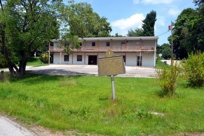
Pittsburg and Wilderness Road Marker image. Click for full size.
Photographed By Duane Hall, August 9, 2015
2. Pittsburg and Wilderness Road Marker
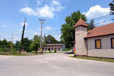
Intersection of Kentucky Highway 3434, Old Crab Orchard Road, and Slate Lick Road image. Click for full size.
Photographed By Duane Hall, August 9, 2015
3. Intersection of Kentucky Highway 3434, Old Crab Orchard Road, and Slate Lick Road
Marker is at northwest corner of intersection
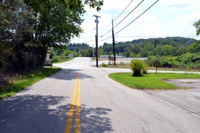
View to South from Kentucky Highway 3434 image. Click for full size.
Photographed By Duane Hall, August 9, 2015
4. View to South from Kentucky Highway 3434
Marker is on right (west) side of highway
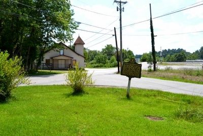
Pittsburg and Wilderness Road Marker image. Click for full size.
Photographed By Duane Hall, August 9, 2015
5. Pittsburg and Wilderness Road Marker
View to south
 
 
Credits. This page was last revised on June 16, 2016. It was originally submitted on September 5, 2015, by Duane Hall of Abilene, Texas. This page has been viewed 466 times since then and 49 times this year. Photos:   1, 2, 3, 4, 5. submitted on September 5, 2015, by Duane Hall of Abilene, Texas.
Share this page.  
Share on Tumblr
m=88210

CeraNet Cloud Computing sponsors the Historical Marker Database.
This website earns income from purchases you make after using our links to Amazon.com. We appreciate your support.
Paid Advertisement
Apr. 18, 2024