Sunset Hill in Kansas City in Jackson County, Missouri — The American Midwest (Upper Plains)
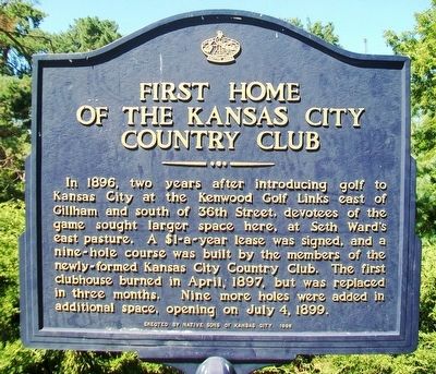
First Home of the Kansas City Country Club
Inscription.
In 1896, two years after introducing golf to Kansas City at the Kenwood Golf Links east of Gilham and south of 36th Street, devotees of the game sought larger space here, at Seth Ward's east pasture. A $1-a-year lease was signed, and a nine-hole course was built by the members of the newly-formed Kansas City Country Club. The first clubhouse burned in April, 1897, but was replaced in three months. Nine more holes were added in additional space, opening on July 4, 1899.
Erected 1998 by Native Sons and Daughters of Greater Kansas City.
Topics and series. This historical marker is listed in these topic lists: Parks & Recreational Areas • Sports. In addition, it is included in the Kansas City - Native Sons and Daughters of Greater Kansas City series list. A significant historical month for this entry is April 1897.
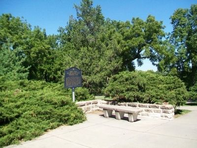
Location. 39° 2.037′ N, 94° 35.612′ W. Marker is in Kansas City, Missouri, in Jackson County. It is in Sunset Hill. Marker is north of the Shelter House in Loose Park, off Wornall Road, south of 51st Street. Touch for map. Marker is at or near this postal address: 5200 Wornall Road, Kansas City MO 64112, United States of America. Touch for directions.
Other nearby markers. At least 8 other markers are within walking distance of this marker. Centennial Anniversary of Japan's Gift of Cherry Trees (within shouting distance of this marker); Union Artillery (about 400 feet away, measured in a direct line); Carolyne Farwell Fuller (about 500 feet away); Confederate Position (about 600 feet away); The French and the Osage (about 700 feet away); McGhee's Charge (approx. ¼ mile away); Battle of Westport (approx. 0.3 miles away); Union Position (approx. 0.4 miles away). Touch for a list and map of all markers in Kansas City.
Also see . . .
1. Kansas City Country Club Clubhouse Vintage Postcard. (Submitted on September 6, 2015, by William Fischer, Jr. of Scranton, Pennsylvania.)
2. Kansas City Country Club at Wikipedia. (Submitted on September 6, 2015, by William Fischer, Jr. of Scranton, Pennsylvania.)
3. The Kansas City Country Club. (Submitted on September 6, 2015, by William Fischer, Jr. of Scranton, Pennsylvania.)
4. Loose Park, KC MO. (Submitted on September 6, 2015, by William Fischer, Jr. of Scranton, Pennsylvania.)
Credits. This page was last revised on February 10, 2023. It was originally submitted on September 6, 2015, by William Fischer, Jr. of Scranton, Pennsylvania. This page has been viewed 461 times since then and 27 times this year. Photos: 1, 2. submitted on September 6, 2015, by William Fischer, Jr. of Scranton, Pennsylvania.

