Downtown Memphis in Shelby County, Tennessee — The American South (East South Central)
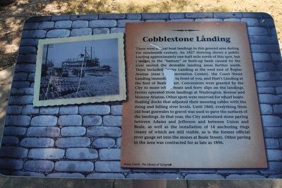
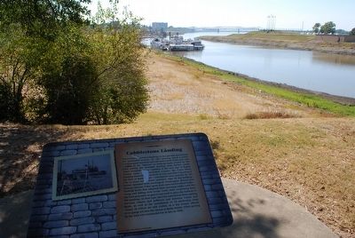
Cobblestone Landing
There were several boat landings in this general area during the nineteenth century. An 1827 drawing shows a public landing approximately on-half mile north of this spot, but changes in the "batture" or built-up bank caused by the river moved the desirable landing areas further south. These included Center Landing at the west end of Poplar Avenue (near the Convention Center), the Court Street Landing immediately in front of you, and Hart's Landing at the foot of Beale Street. Concessions were granted by the City to moor whole boats and ferry slips on the landings. Ferries operated from landings at Washington Avenue and Monroe Avenue. Other spots were reserved for wharf boats-floating docks that adjusted their mooring cables with the rising and falling river levels. Until 1860, everything from old boat gunwales to gravel was used to pave the surfaces of the landings. In that year, the City authorized stone paving between Adams and Jefferson and between Union and Beale, as well as the installation of 14 anchoring rings (many of which are still visible, as is the former official river gauge set into stone at Beale Street). Other paving in the area was contracted for as late as 1896.
Topics. This historical marker is listed in this topic list: Waterways & Vessels. A significant historical year for this entry is 1827.
Location. 35° 8.815′ N, 90° 3.331′ W. Marker is in Memphis, Tennessee, in Shelby County. It is in Downtown Memphis. Marker can be reached from Riverside Drive. Located in the Jefferson Davis Park off Riverside Drive. Touch for map. Marker is in this post office area: Memphis TN 38103, United States of America. Touch for directions.
Other nearby markers. At least 8 other markers are within walking distance of this marker. Mississippi River Park (within shouting distance of this marker); Mud Island (within shouting distance of this marker); Fort Adams, Mississippi/Old River Control Structure/Homochitto Cutoff (within shouting distance of this marker); Confederate Park (about 300 feet away, measured in a direct line); Naval Battle of Memphis, 1862 (about 300 feet away); Confederate History of Memphis (about 400 feet away); Ida B. Wells (about 400 feet away); Alma H. Law (about 400 feet away). Touch for a list and map of all markers in Memphis.
Credits. This page was last revised on February 7, 2023. It was originally submitted on September 7, 2015, by Brandon Fletcher of Chattanooga, Tennessee. This page has been viewed 400 times since then and 37 times this year. Photos: 1, 2, 3, 4. submitted on September 7, 2015, by Brandon Fletcher of Chattanooga, Tennessee. • Bill Pfingsten was the editor who published this page.


