Moran in Teton County, Wyoming — The American West (Mountains)
Valley View
Grand Teton National Park
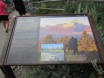
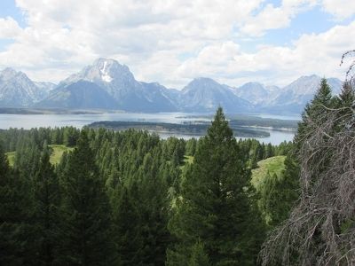
From this vantage point, notice how the landscape spreads before you. Geology controls the park’s natural communities from valley wetlands to the mountain alpine. Ice-age glaciers periodically blanketed this landscape last retreating 14,000 years ago leaving behind river channels, outwash plains, glacial moraines, potholes, deep canyons and jagged peaks.
Glaciers act like conveyor belts depositing rocky debris as ridges called moraines that contain rocks ground to the consistency of flour. Rock flour retains moisture allowing lodgepole pine forests to flourish on these moraines.
As glaciers retreat, blocks of ice drop to the valley floor and become buried in outwash gravel. When the ice melts, the resulting depression or pothole forms a pocket of forest or wetland surrounded by a sea of sagebrush in the outwash plain.
Erected by National Park Service.
Topics. This historical marker is listed in this topic list: Natural Features.
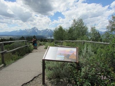
Location. 43° 50.753′ N, 110° 34.537′ W. Marker is in Moran, Wyoming, in Teton County. Marker can be reached from Signal Mountain Road, on the right when traveling east. Marker is located at the west overlook near the summit of Signal Mountain in Grand Teton National Park. Touch for map. Marker is in this post office area: Moran WY 83013, United States of America. Touch for directions.
Other nearby markers. At least 8 other markers are within 4 miles of this marker, measured as the crow flies. Cattleman's Bridge (approx. 1.3 miles away); The Teton Range (approx. 1.9 miles away); Young, Restless, and Still Rising (approx. 1.9 miles away); 11,000 Summers in the Tetons (approx. 2 miles away); A New Era (approx. 2.2 miles away); Grand Teton National Park (approx. 2.2 miles away); Jackson Lake Lodge (approx. 2.2 miles away); Cattle King of Wyoming (approx. 3.4 miles away). Touch for a list and map of all markers in Moran.
More about this marker. The right side of the marker features photographs of the Teton Range and the Snake River. They have a caption of “Melting glaciers washed away soil and left behind quartzite cobbles, gravel and sand forming the outwash plain where sagebrush thrives today. The meltwater carved channels into the outwash plain reflected in the wetlands along the Snake River.”
Credits. This page was last revised on June 16, 2016. It was originally submitted on September 7, 2015, by Bill Coughlin of Woodland Park, New Jersey. This page has been viewed 340 times since then and 17 times this year. Photos: 1, 2, 3. submitted on September 7, 2015, by Bill Coughlin of Woodland Park, New Jersey.


