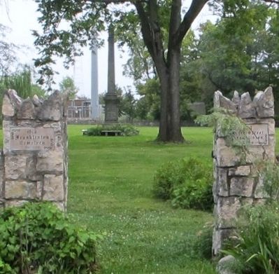
Franklinton in Columbus in Franklin County, Ohio — The American Midwest (Great Lakes)
In This Churchyard
(side A)
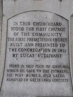
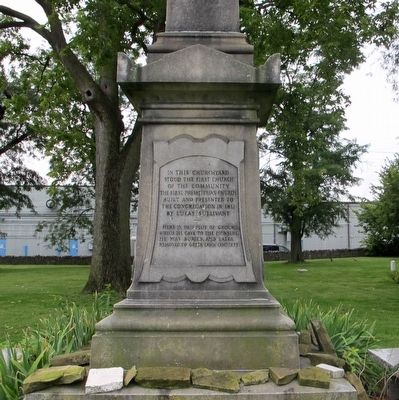
In this churchyard stood the first church of the community, The First Presbyterian Church, built and presented to the congregation in 1811 by Lucas Sullivant.
Here in this plot of ground, which he gave to the pioneers, he was buried, and later removed to Green Lawn Cemetery.
(side B)
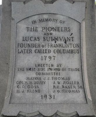
In memory of the Pioneers and Lucas Sullivant, founder of Franklinton, later called Columbus, 1797.
Erected 1931 by West Side Board of Trade Committee.
Topics. This historical marker is listed in these topic lists: Cemeteries & Burial Sites • Churches & Religion • Settlements & Settlers. A significant historical year for this entry is 1797.
Location. 39° 57.767′ N, 83° 1.326′ W. Marker is in Columbus, Ohio, in Franklin County. It is in Franklinton. Marker can be reached from the intersection of North Davis Avenue and River Street, on the right when traveling north. Located in the Old Franklinton Cemetery. Touch for map. Marker is at or near this postal address: 778 River Street, Columbus OH 43222, United States of America. Touch for directions.
Other nearby markers. At least 8 other markers are within walking distance of this marker. Old Franklinton Cemetery Archaeology (within shouting distance of this marker); Old Franklinton Cemetery (within shouting distance of this marker); Franklinton (approx. 0.4 miles away); a different marker also named Franklinton (approx. 0.4 miles away); The Harrison House (approx. 0.4 miles away); a different marker also named Franklinton (approx. 0.4 miles away); Council Site Between William Henry Harrison and Indians (approx. 0.4 miles away); Maurice Gates (approx. half a mile away). Touch for a list and map of all markers in Columbus.
Credits. This page was last revised on February 3, 2023. It was originally submitted on September 7, 2015, by Rev. Ronald Irick of West Liberty, Ohio. This page has been viewed 394 times since then and 22 times this year. Photos: 1, 2, 3, 4, 5. submitted on September 7, 2015, by Rev. Ronald Irick of West Liberty, Ohio. • Bernard Fisher was the editor who published this page.
