
Mammoth in Yellowstone National Park in Park County, Wyoming — The American West (Mountains)
Volcanic Landscape
Photographed by Bill Coughlin, August 1, 2015
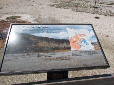
1. Volcanic Landscape Marker
The high cliffs around you were created after the last volcanic eruption in the Yellowstone region, about 630,000 years ago. The powerful eruption ejected ash as far away as Nebraska and Texas, expelling magma from an underground chamber more than 30 miles in diameter. As the roof of the chamber collapsed, a caldera or crater, was formed spanning nearly half of Yellowstone National Park. In time, massive lava flows, filled the caldera, creating the present landscape including the cliffs before you.
The evidence of Yellowstone’s volcanic events are all around you. The heat from magma still beneath the surface powers the park’s geysers, hot springs, fumaroles (steam vents), and mud pots.
Erected by Yellowstone National Park.
Topics. This historical marker is listed in this topic list: Natural Features.
Location. 44° 27.723′ N, 110° 51.287′ W. Marker is in Yellowstone National Park, Wyoming, in Park County. It is in Mammoth. It is on Lower Grand Loop Road, on the right when traveling south. Marker is located in the Black Sand Basin in Yellowstone National Park. Touch for map.
this page online

Regionally, this marker is in the Bighorn Basin and in Greater Yellowstone. It is also in the American Mountain West and in the Lewis & Clark Corridor. Globally, it is in North America, the Rocky Mountains, the Western Hemisphere, the Western World, and the Anglosphere.
Other nearby markers. At least 8 other markers are within walking distance of this marker: Black Sand Basin (about 300 feet away, measured in a direct line); Living on the Edge (about 300 feet away); Daisy Geyser (approx. ¾ mile away); Castle Geyser (approx. 0.9 miles away); Beauty and Chromatic Pools (approx. 0.9 miles away); Giant Geyser (approx. 0.9 miles away); Grand Geyser (approx. 0.9 miles away); Crested Pool (approx. 0.9 miles away). Touch for a list and map of all markers in Yellowstone National Park.
More about this marker. The background of the marker contains a photograph of the Rhyolite Cliff Face seen from the marker. A map of Yellowstone National Park on the right side of the marker shows the location of the Yellowstone
Photographed by Bill Coughlin, August 1, 2015
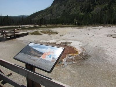
2. Volcanic Landscape Marker
Photographed by Bill Coughlin, August 1, 2015
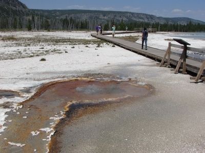
3. Marker at the Black Sand Basin
Credits. This page was last revised on February 16, 2023. It was originally submitted on September 8, 2015, by Bill Coughlin of Woodland Park, New Jersey. This page has been viewed 351 times since then and 14 times this year. Photos: 1, 2, 3. submitted on September 8, 2015, by Bill Coughlin of Woodland Park, New Jersey.
