Antiguo Cuscatlán, La Libertad, El Salvador — Central America (West Coast)
Quetzalcoat's Stone
Piedra Tacitas
Photographed by J. Makali Bruton, August 30, 2015
1. Quetzalcoat's Stone Marker

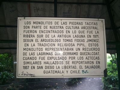
The “stones of the little cups” monoliths are part of our ancestral culture. They were found near here in what was the southern edge of the ancient crater lake in 1971. According to archaeologist Tomas Fideas Jimenez, in the Pipil religious tradition, these monoliths represented the myth of the tears that Quetzalcoat shed when he was thrown out by the Aztecs. Similar stones were reported in 1957 in San Diego, La Libertad, El Salvador, as well as in Guatemala and Chile.
Topics. This historical marker is listed in this topic list: Anthropology & Archaeology. A significant historical year for this entry is 1971.
Location. 13° 40.183′ N, 89° 14.769′ W.
this page online

Regionally, it is in North America, specifically in Central America, in Mesoamerica, on the Ring of Fire, on the Pacific Rim, and in the Western Hemisphere. Historically, it finds itself in what was once New Spain and also a Spanish colony.
Other nearby markers. At least 8 other markers are within walking distance of this marker: Fritz Hamer (about 120 meters away, measured in a direct line); Francisco Bogen (about 180 meters away); Mother Cesarita Ruiz de Esparza y Dávalos (approx. 0.8 kilometers away); General José María Cañas Highway (approx. 1.2 kilometers away); In Memory of Those Americans Who Lost Their Lives in El Salvador (approx. 1.3 kilometers away); Plaza Brasilia (approx. 1.4 kilometers away in San Salvador); Ceiba de Guadalupe Church (approx. 1.4 kilometers away in San Salvador); Construction of the North-South Highway and the Central American University
Photographed by J. Makali Bruton, August 30, 2015
2. Quetzalcoat's Stone Marker
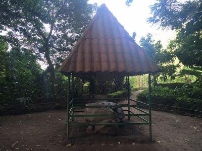
The marker is underneath the stone's protective roof.
Photographed by J. Makali Bruton, August 30, 2015
3. Quetzalcoat's Stone
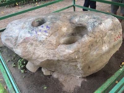
Quetzalcoat's tears supposedly caused the hollowed-out depressions in the stone. Recent research seems to point to their being used to hold water as part of Pipil religious ceremonies.
Credits. This page was last revised on May 17, 2021. It was originally submitted on September 9, 2015, by J. Makali Bruton of Washington, District of Columbia. This page has been viewed 600 times since then and 23 times this year. Photos: 1, 2, 3. submitted on September 9, 2015, by J. Makali Bruton of Washington, District of Columbia.
