Port Allen in West Baton Rouge Parish, Louisiana — The American South (West South Central)
Calumet Plantation
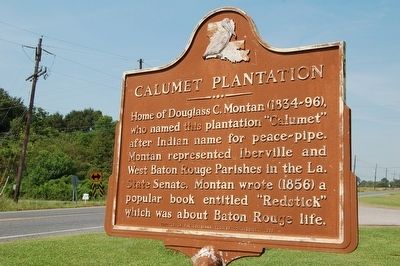
Photographed by Cajun Scrambler, September 5, 2015
1. Calumet Plantation Marker
Erected 1971 by The Louisiana Tourist Commission.
Topics. This historical marker is listed in these topic lists: Agriculture • Arts, Letters, Music • Settlements & Settlers.
Location. 30° 28.111′ N, 91° 16.741′ W. Marker is in Port Allen, Louisiana, in West Baton Rouge Parish. It is on Rosedale Road (State Highway 76) near Calumet Road (State Highway 1145), on the right when traveling west. Touch for map. Marker is in this post office area: Port Allen LA 70767, United States of America. Touch for directions.

Regionally, this marker is in one of Louisiana’s River Parishes, in Acadiana — Cajun Country, and in Greater Baton Rouge. It is also in the American South, specifically in the Deep South, and in the Great River Road Region. Globally, it
this page online
Other nearby markers. At least 8 other markers are within 5 miles of this marker, measured as the crow flies: Allendale Plantation (approx. 1½ miles away); Rosedale Road (approx. 1.8 miles away); Old Cohn High School (approx. 3.7 miles away); Cohn High School (approx. 3.7 miles away); James "Slim Harpo" Moore (approx. 3.9 miles away); Stone Square Lodge No. 8 (approx. 4 miles away); West Baton Rouge Parish Bicentennial (approx. 4.2 miles away); Port Allen High School (1936-1978) / Port Allen Middle School (1979-Present) (approx. 4.3 miles away). Touch for a list and map of all markers in Port Allen.
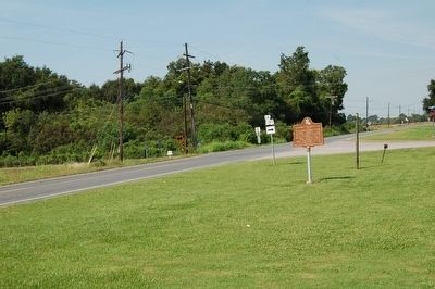
Photographed by Cajun Scrambler, September 5, 2015
2. Calumet Plantation Marker
Credits. This page was last revised on October 22, 2023. It was originally submitted on September 10, 2015. This page has been viewed 816 times since then and 70 times this year. Photos: 1, 2. submitted on September 10, 2015. • Bernard Fisher was the editor who published this page.
