Fort Hunter in Montgomery County, New York — The American Northeast (Mid-Atlantic)
Once A Farm
Schoharie Crossing
— State Historic Site —
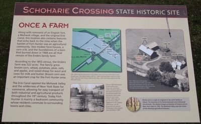
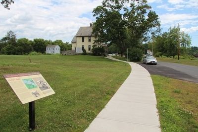
Along with remnants of an English fort, a Mohawk village, and the original Erie Canal, this location also contains features that echo back to the time when the hamlet of Fort Hunter was an agricultural community. Two modest farm houses, a corn crib, and the foundations of a barn that burned down in 1969 are all that remain of the Enders family barn.
According to the 1855 census, the Enders farm was 522 acres. The family grew broom corn, wheat, potatoes, peas, oats, and applies, and raised sheep for wool and cows for milk and butter. Broom corn was an important crop for the Fort Hunter area.
The Erie Canal opened the Mohawk Valley and the wilderness of New York State for commerce, allowing for easy transport of both industrial and agricultural products throughout the 19th century. Today Fort Hunter is mainly a bedroom community whose residents commute to surrounding towns and cities.
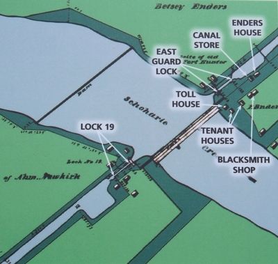
The 1834 Holmes Hutchinson map depicts the area around the Erie Canal's Guard Lock. The Enders House, built ca 1800. may have been used as a canal store. The map also shows a blacksmith shop, and a toll house adjacent to the lock and house.
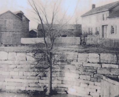
This ca. 1880 photograph of the Enders farm shows the Schoharie Creek retaining wall and the home that stood at this location before the farmhouse that is now how to the Visitor Center. Although we do not know what happened to the original farmhouse, we do know that the second farmhouse in this location was standing in 1900.
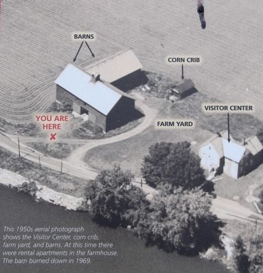
This 1950s aerial photograph shows the Visitor Center, corn crib, farm yard, and barns. At this time there were rental apartments in the farmhouse. The barn burned down in 1969.
Broom corn is a type of sorghum in the same family as wheat. The branches of its flowering head were fashioned into brooms. The Shakers began production of broom corn New York State in 1790. The Mohawk Valley was the center of this thriving agricultural industry.
Topics. This historical marker is listed in these topic lists: Agriculture • Industry & Commerce • Waterways & Vessels.
Location. 42° 56.38′ N, 74° 16.957′ W. Marker is in Fort Hunter, New York, in Montgomery County. Marker is on Schoharie Street south of Main Street, on the left when traveling south. This marker is on the site of the grounds of the Schoharie Crossing, State Historic Site, just north of the State Historic Site Visitor Center, between the Visitor Center and the visitor's parking lot. Touch for map. Marker is in this post office area: Fort Hunter NY 12069, United States of America. Touch for directions.
Other nearby markers. At least 8 other markers are within walking distance of this marker. In the Wake of Hurricane Irene (a few steps from this marker); Canal Dams
(within shouting distance of this marker); The Fort by the Village (within shouting distance of this marker); Building Block of the Erie Canal (within shouting distance of this marker); Site of Queen Anne Chapel (within shouting distance of this marker); Original Erie Canal (within shouting distance of this marker); East Guard Lock (within shouting distance of this marker); Site of Last Mohawk Indian Village (within shouting distance of this marker). Touch for a list and map of all markers in Fort Hunter.
Photographed By Dale K. Benington, July 23, 2015
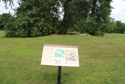
3. Once A Farm Marker
Close-up view, that is displayed on the marker, of a ca. 1880 photograph of the Enders farm showing the Schoharie Creek retaining wall and the home that stood at this location before the farmhouse that is now home to the Visitor Center.
Credits. This page was last revised on June 16, 2016. It was originally submitted on September 12, 2015, by Dale K. Benington of Toledo, Ohio. This page has been viewed 353 times since then and 22 times this year. Photos: 1, 2, 3, 4, 5, 6. submitted on September 13, 2015, by Dale K. Benington of Toledo, Ohio.
