Near Jamestown in Newport County, Rhode Island — The American Northeast (New England)
The Granite Light Tower
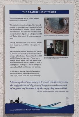
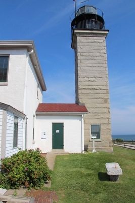
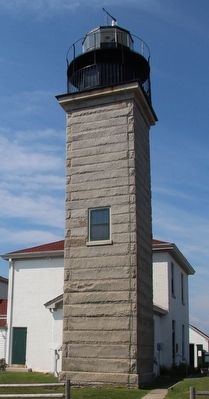
The current tower was built in 1856 to replace a deteriorating 1753 structure.
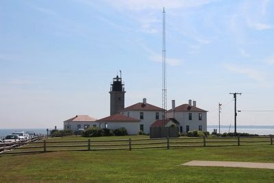
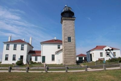
The granite tower rises to a height of 40.9 feet and measures 10 feet on each side. It is constructed of 27 rows of granite blocks, weighing a total of 180 tons. The cast iron and steel top section includes a watch room and a lantern (light) room adding another 15.3 feet. The top of the tower is 85 feet above mean low water.
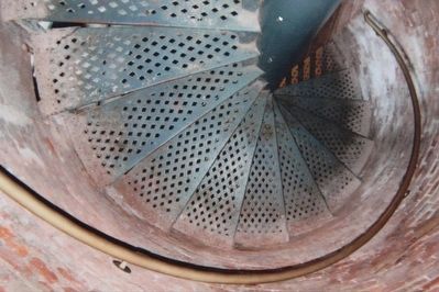
Although the outside of the tower is square, the interior is circular and is brick lined with a spiral iron staircase.
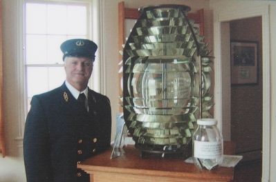
Over the past 150 years the Beavertail Light has used oil, kerosene and electricity for illumination with a variety of light colors and characteristics. From 1856 until 1991 Beavertail Light used a Fresnel lens, a sparkling beehive of glass that is now housed in the Museum that could be seen at a range of 15 miles. A rotating beacon emitting a 2.5 million-candlepower beam replaced the Fresnel lens and is in use today.
In 2009, a grant from the Champlin Foundations repaired the exterior stonework and restored the watch room, lantern room, iron decks and railings.
I often heard my father tell about a vessel going on the rocks south of the light and how men came ashore carrying pails of cider and rolling pins, part of the cargo. In a severe storm, when another craft was grounded, one of the crew made his way ashore, carrying a heavy sea chest on his back.
Lena Clark daughter of Beavertail Keeper Silas Gardner Shaw
Erected by Beavertail Lighthouse Museum Association.
Topics and series. This historical marker is listed in these topic lists: Industry & Commerce • Waterways & Vessels. In addition, it is included in the Lighthouses series list. A significant historical year for this entry is 1856.
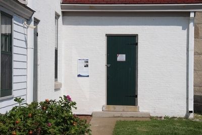
Location. 41° 26.965′ N, 71° 23.967′ W. Marker is near Jamestown, Rhode Island, in Newport County. Marker is on Beavertail Road south of Clarkes Village Road, on the left when traveling south. This marker is located in the Beavertail State Park, affixed to the outside wall, beside the front entrance door, that is nearest to the granite light tower. Touch for map. Marker is in this post office area: Jamestown RI 02835, United States of America. Touch for directions.
Other nearby markers. At least 8 other markers are within walking distance of this marker. Fog Signal Building (here, next to this marker); The Keeper's House (a few steps from this marker); The West Passage to Narragansett Bay (a few steps from this marker); The Assistant Keeper's House (a few steps from this marker); Oil Storage Building (a few steps from this marker); Whale Rock Lighthouse
(a few steps from this marker); History of the Beavertail Light Station (a few steps from this marker); The 1749 Foundation (within shouting distance of this marker). Touch for a list and map of all markers in Jamestown.
Credits. This page was last revised on June 16, 2016. It was originally submitted on September 15, 2015, by Dale K. Benington of Toledo, Ohio. This page has been viewed 341 times since then and 8 times this year. Photos: 1, 2, 3, 4, 5, 6, 7, 8. submitted on September 15, 2015, by Dale K. Benington of Toledo, Ohio.
