Near Jamestown in Newport County, Rhode Island — The American Northeast (New England)
Fog Signal Building
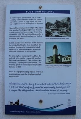
In 1829, Congress appropriated $1,250 for a 600-pound fog bell for Beavertail. Prior to that time the keeper fired a cannon on foggy nights. That same year a fog bell house was built adjacent to the tower.
Beavertail has probably seen more types of fog signals than any other New England lighthouse. An air fog trumpet powered by a horse driving a 10-foot wheel was added in 1851. This was followed by a number of innovations, with Beavertail usually one of the first to field-test new devices.
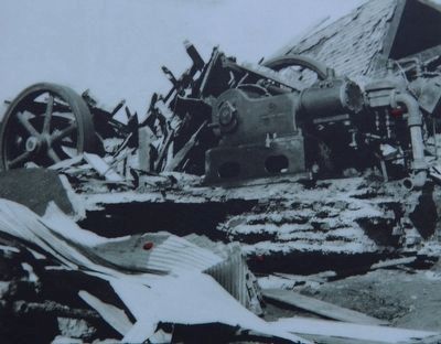
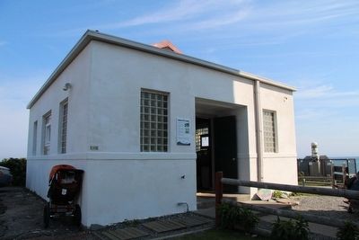
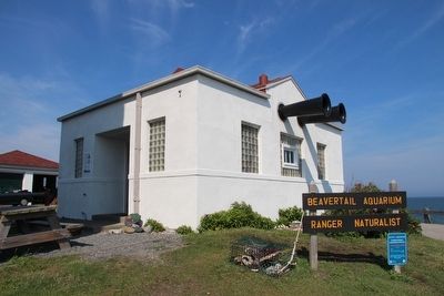
In 1939, after the Great Hurricane of 1938 destroyed the fog signal building, the Coast Guard built this structure. It contained air modulated fog signal equipment, an emergency generator, an air compressor and compressed air storage tanks.
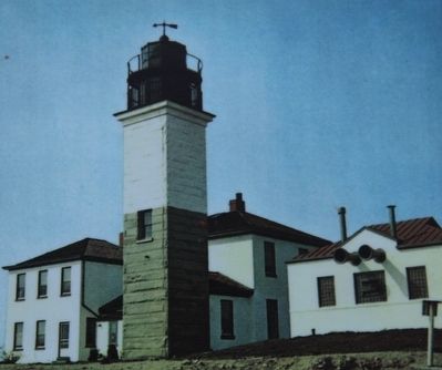
Two large diaphone trumpets protruded from the south side of the building (you can still see where the trumpet openings were). These emitted a two-tone signal: a high frequency tone and then a low frequency "grunt." A siren compressor replaced the diaphones in 1962.
Its use as a fog signal building ended in 1971 when an automatic electronic fog signal was installed across the road.
(The foghorn) was installed in a house by the road so that the motorist had to drive directly in front of it. If the visitor listened carefully in a fog, he could hear a sound resembling the clanking of a chain in a dungeon. Then suddenly would come a blast that would shiver the timbers of a cast iron dog.
Bertram Lippincott, Jamestown Sampler
Erected by Beavertail Lighthouse Museum Association.
Topics and series. This historical marker is listed in these topic lists: Industry & Commerce • Waterways & Vessels. In addition, it is included in the Lighthouses series list.
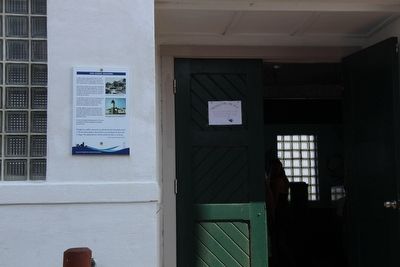
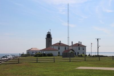
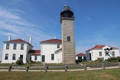
Location. 41° 26.967′ N, 71° 23.964′ W. Marker is near Jamestown, Rhode Island, in Newport County. Marker is on Beavertail Road south of Clarkes Village Road, on the left when traveling south. This marker is located in the Beavertail State Park, affixed to the outside wall, beside the front entrance door of the fog signal building, in the southeast section of the existing lighthouse complex. Touch for map. Marker is in this post office area: Jamestown RI 02835, United States of America. Touch for directions.
Other nearby markers. At least 8 other markers are within walking distance of this marker. The Granite Light Tower (here, next to this marker); The Keeper's House (here, next to this marker); Oil Storage Building (a few steps from this marker); The West Passage to Narragansett Bay (a few steps from this marker); The Assistant Keeper's House (a few
steps from this marker); History of the Beavertail Light Station (a few steps from this marker); Whale Rock Lighthouse (within shouting distance of this marker); The 1749 Foundation (within shouting distance of this marker). Touch for a list and map of all markers in Jamestown.
Credits. This page was last revised on June 16, 2016. It was originally submitted on September 15, 2015, by Dale K. Benington of Toledo, Ohio. This page has been viewed 456 times since then and 33 times this year. Photos: 1, 2, 3, 4, 5, 6, 7, 8. submitted on September 15, 2015, by Dale K. Benington of Toledo, Ohio.
