
Mammoth in Yellowstone National Park in Park County, Wyoming — The American West (Mountains)
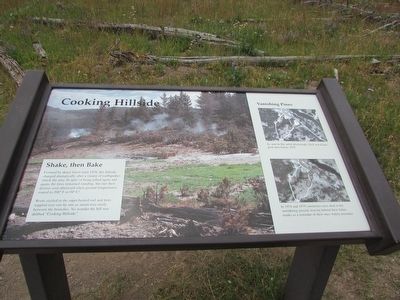
Cooking Hillside
Photographed by Bill Coughlin, July 26, 2015
1. Cooking Hillside Marker
Shake, then Bake
Covered by dense forest until 1978, this hillside changed dramatically after a swarm of earthquakes struck the area. In spite of being jolted again and again, the trees remained standing, but met their demise soon afterward when ground temperatures soared to 200° F or 94° C!
Roots sizzled in the super-heated soil and trees toppled over one by one as steam rose eerily between the branches. No wonder the hill was dubbed “Cooking Hillside.”
Erected by National Park Service.
Topics. This historical marker is listed in this topic list: Natural Features.
Location. 44° 37.416′ N, 110° 25.979′ W. Marker is in Yellowstone National Park, Wyoming, in Park County. It is in Mammoth. It is on Grand Loop Road, on the left when traveling north. Marker is located on a path at the Mud Volcano area. Touch for map. Marker is in this post office area: Yellowstone National Park WY 82190, United States of America. Touch for directions.

Regionally, this marker is in the Bighorn Basin and in Greater Yellowstone. It is also in the American Mountain West and
this page online
Other nearby markers. At least 8 other markers are within walking distance of this marker: Mud Geyser (about 300 feet away, measured in a direct line); Dragon's Mouth Spring (about 500 feet away); Mud Volcano (about 500 feet away); Grizzly Fumarole (about 700 feet away); Churning Caldron (approx. 0.2 miles away); Black Dragon’s Caldron (approx. ¼ mile away); Volcanic Landscape (approx. 0.3 miles away); Sulphur Caldron (approx. 0.3 miles away). Touch for a list and map of all markers in Yellowstone National Park.
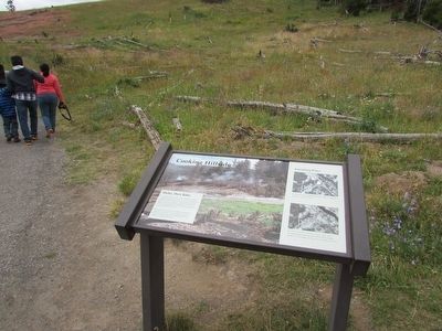
More about this marker. The background of the marker features a photograph of the hillside. Two “before and after” photos appear on the right side of the marker under the heading “Vanishing Pines”. The top one has a caption of “As seen in this aerial photograph, thick woodlands grew here before 1987.” The second photo has the caption “In 1978 and 1979, numerous trees died in the smoldering ground, leaving behind their fallen
Photographed by Bill Coughlin, July 26, 2015
2. Cooking Hillside Marker
Photographed by Bill Coughlin, July 26, 2015
3. Cooking Hillside
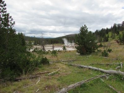
Many of the dead trees and the thermal features that led to their demise can be seen in this photo that was taken near the marker.
Credits. This page was last revised on February 16, 2023. It was originally submitted on September 15, 2015, by Bill Coughlin of Woodland Park, New Jersey. This page has been viewed 689 times since then and 28 times this year. Photos: 1, 2, 3. submitted on September 15, 2015, by Bill Coughlin of Woodland Park, New Jersey.
