
Mammoth in Yellowstone National Park in Park County, Wyoming — The American West (Mountains)
Mud Geyser
Photographed by Bill Coughlin, July 26, 2015
1. Mud Geyser Marker
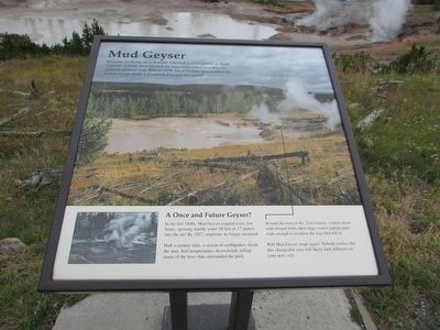
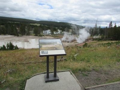
Imagine walking on a densely forested trail to arrive at Mud Geyser – a trail once shaded by trees now criss-crossing the ground around you. Before 1978, Mud Geyser was hidden by forest except from a platform beyond this point!
A Once and Future Geyser?
In the late 1800s, Mud Geyser erupted every few hours, spewing muddy water 50 feet or 17 meters into the air! By 1927, eruptions no longer occurred.
Half a century later, a swarm of earthquakes shook the area. Soil temperatures skyrocketed, killing many of the trees that surrounded the pool.
Around the turn of the 21st Century, violent steam vents hissed forth, their large craters gaping open wide enough to swallow the logs that fell in.
Will Mud Geyser erupt again? Nobody knows, but this changeable area will likely look different on your next visit.
Erected by National Park Service.
Topics. This historical marker is listed in this topic list: Natural Features.
Location. 44° 37.361′ N, 110° 25.97′ W. Marker is in Yellowstone National Park, Wyoming, in Park County. It is in Mammoth. It can be reached from Grand Loop
this page online

Regionally, this marker is in the Bighorn Basin and in Greater Yellowstone. It is also in the American Mountain West and in the Lewis & Clark Corridor. Globally, it is in North America, the Rocky Mountains, the Western Hemisphere, the Western World, and the Anglosphere.
Other nearby markers. At least 8 other markers are within walking distance of this marker: Cooking Hillside (about 300 feet away, measured in a direct line); Churning Caldron (about 700 feet away); Grizzly Fumarole (about 700 feet away); Dragon's Mouth Spring (approx. 0.2 miles away); Mud Volcano (approx. 0.2 miles away); Black Dragon’s Caldron (approx. 0.2 miles away); Volcanic Landscape (approx. 0.4 miles away); Sulphur Caldron (approx. 0.4 miles away). Touch for a list and map of all markers in Yellowstone National Park.
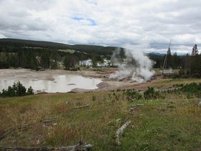
More about this marker. The top of the marker features a photograph of how Mud Geyser appears
Photographed by Bill Coughlin, July 26, 2015
2. Mud Geyser Marker
Photographed by Bill Coughlin, July 26, 2015
3. Mud Geyser
Credits. This page was last revised on February 16, 2023. It was originally submitted on September 15, 2015, by Bill Coughlin of Woodland Park, New Jersey. This page has been viewed 785 times since then and 20 times this year. Photos: 1, 2, 3. submitted on September 15, 2015, by Bill Coughlin of Woodland Park, New Jersey.
