Canton in St. Lawrence County, New York — The American Northeast (Mid-Atlantic)
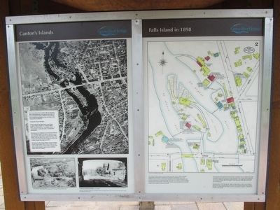
Canton's Islands / Falls Island in 1898
Inscription.
Canton's Islands
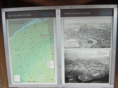
The Grasse River flows north to the St. Lawrence River and divides into west and east channels as it flows around the islands. Stillman Foote built the first sawmill and gristmill on the west bank of the Grasse River in 1801-02.
Getting the Names Straight:
On the south side of Main Street, what today is called "Willow Island" or "Canton Island Park" was once known as "Champlin Island" or "Cook Island," taking the names of prominent businessmen.
The land you are standing on now has been referred to as "Coakley Island" for almost a hundred years. But during the 19th century it was known as "Mill Island" and was where A.E. Smith, L.B. Storrs, and Gardner and Veitch had their businesses before J.P. Coakley bought the property in 1917.
The King Iron Bridge connects Coakley Island to Falls Island. This 4.4 acre island was the heart of 19th century Canton industry. Early maps refer to Falls Island by names such as Hodskin, Spears, Huse, or Coakley.
Dwight Church, 1939; SLU ODY Archives "The Grasse River Flowing Through Canton"
Dwight Church, 1958, SLU, ODY Archives. "Over Falls Island Looking South at Coakley Island, Canton's Main Street Bridges, Canton's Main Street Bridges and Willow Island."
Canton Town and Village Historian's Office. "Looking East on Main Street, Through the Covered Bridge."
Built in 1867, and replaced in 1904, this covered bridge crossed the west channel of the Grasse River and served as the entry way from Ogdensberg or Gouverneur.
Topics. This historical marker is listed in these topic lists: Bridges & Viaducts • Industry & Commerce • Waterways & Vessels. A significant historical year for this entry is 1801.
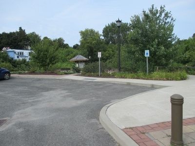
Location. 44° 35.738′ N, 75° 10.491′ W. Marker is in Canton, New York, in St. Lawrence County. Marker can be reached from West Main Street (U.S. 11) 0.2 miles east of Governeur Street (U.S. 11). Marker is on a triangular shelter style kiosk in Heritage Park at the parking lot on Willow Island, north side of US 11. Touch for map. Marker is in this post office area: Canton NY 13617, United States of America. Touch for directions.
Other nearby markers. At least 8 other markers are within walking distance of this marker. The King Iron Bowstring Bridge (within shouting distance of this marker); The West Channel of the Grasse River (within shouting distance of this marker); The Grist Mill (within shouting distance of this marker); The Sash and Blind Factory (about 300 feet away, measured in a direct line); Water Street and the Third Dam (about 300 feet away); The East Channel of the Grasse River (about 300 feet away); Logging and Lumbering (about 400 feet away); Rushton Boat Shop (about 500 feet away). Touch for a list and map of all markers in Canton.
Credits. This page was last revised on June 16, 2016. It was originally submitted on September 16, 2015, by Anton Schwarzmueller of Wilson, New York. This page has been viewed 401 times since then and 15 times this year. Photos: 1. submitted on September 16, 2015, by Anton Schwarzmueller of Wilson, New York. 2, 3. submitted on September 17, 2015, by Anton Schwarzmueller of Wilson, New York. 4. submitted on September 16, 2015, by Anton Schwarzmueller of Wilson, New York.


