Canton in St. Lawrence County, New York — The American Northeast (Mid-Atlantic)
The West Channel of the Grasse River
Inscription.
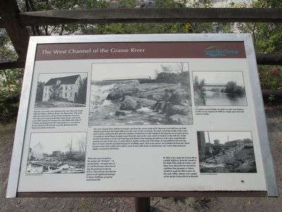
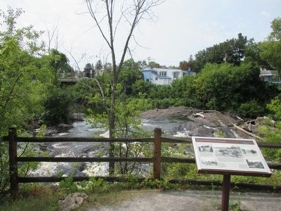
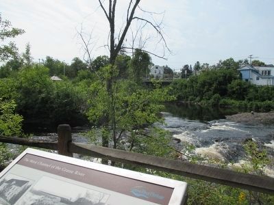
Directly across this west channel is the site where the Eagle Mill was built in 1842 by Henry Van Rensselaer. This grist mill was a four-story, 45 by 65 foot sandstone structure. Over the years it passed through many hands, and in the early 20th century it was known as the Bullis mill. John P. Coakley purchased it in 1917 and used it as a warehouse. It was razed in 1959 and the Cascade Restaurant and Motel were built on the site. Canton Town and Village Historian
The west channel dam, 250 feet in length, ran from the corner of the D.W. Sherwin Grist Mill here on Falls Island to just below the Eagle Mill across the river on the west bank. The dam raised the height of the water and created a mill pond that allowed a number of industries on the islands to develop the use of water power. A wooden or metal flume brought water from the dam to the water wheel or turbine at the mill site. At the mouth of the flume a trash rack kept logs and debris from entering the mill race and a gate controlled the amount of water in the race. A waterwheel or turbine at the end of the flume was propelled by the moving force of water and the gravitational power of falling water. That water power was transferred from the wheel by gears and a drive shaft and could be used to turn mill stones to grind grain, saw wood, chop and press apples or generate electricity. SLHA [St. Lawrence County Historical Association]
When the snows melted in the spring, the "Freshets" - or spring floods-- brought tons of ice and floodwaters that moved logs downstream in the log drives. These floods also had the power to do significant damage to dams, buildings, property, and human life. Canton Town and Village Historian
A wooden covered bridge was built over the west channel in 1863. It was replaced in 1904 by a single span steel and concrete bridge. SLCHA
In 1824, a law made the Grasse River a public highway, from the mouth to the High Falls south of Canton, and dams were allowed to be erected on condition that passages or sluices should be made for fish to pass. In the early 1800s, salmon were caught as far up the Grasse River as Russell. Canton Town and Village Historian
Erected by Grasse River Heritage.
Topics. This historical marker is listed in these topic lists: Bridges & Viaducts • Industry & Commerce • Waterways & Vessels. A significant historical year for this entry is 1842.
Location. 44° 35.761′ N, 75° 10.5′ W. Marker is in Canton, New York, in St. Lawrence County. Marker can be reached from West Main Street (U.S. 11) 0.2 miles east of Governeur Street (U.S. 11). Marker is in Heritage Park, across the
pedestrian bridge, on the trail. Heritage park is on the north side of US 11 between the two bridges over the Grasse River channels. Touch for map. Marker is in this post office area: Canton NY 13617, United States of America. Touch for directions.
Other nearby markers. At least 8 other markers are within walking distance of this marker. The Grist Mill (a few steps from this marker); The Sash and Blind Factory (within shouting distance of this marker); Canton's Islands / Falls Island in 1898 (within shouting distance of this marker); The King Iron Bowstring Bridge (within shouting distance of this marker); The East Channel of the Grasse River (within shouting distance of this marker); Water Street and the Third Dam (about 300 feet away, measured in a direct line); Logging and Lumbering (about 300 feet away); Floods, Fires, and Pollution (about 300 feet away). Touch for a list and map of all markers in Canton.
Credits. This page was last revised on June 16, 2016. It was originally submitted on September 17, 2015, by Anton Schwarzmueller of Wilson, New York. This page has been viewed 360 times since then and 10 times this year. Photos: 1, 2, 3. submitted on September 17, 2015, by Anton Schwarzmueller of Wilson, New York.


