Canton in St. Lawrence County, New York — The American Northeast (Mid-Atlantic)
The Sash and Blind Factory
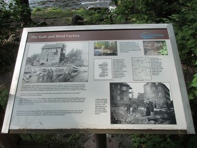
A toilet juts from the second floor. It may have been a convenience for workers, but was by today's standards environmentally insensitive.
A sash and blind factoy such as this supplied a variety of wood products necessary to finish building a house or business establishment, including doors, window sashes, blinds, stairs, brackets, and other interior items. This industry would likely use a considerable quantity of lumber and we can assume that it came from the lumber mill only a few yards away.
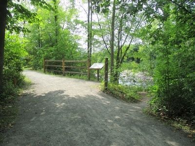
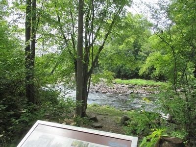
Behind where you are standing, the stone-lined well may have been used for protection from fire. Just a few feet further down the path on the right are nine rectangular blocks that may be partial foundations for the lumber trestles that were used to transport lumber to stacks on the far end of Falls Island.
The stone foundation and the stonework along the head race are prominent features at this site. The northwest corner of the building can be precisely located because we can still find mortar in a notch in the large bolder [sic] that was the foundation corner for the building.
This diagram shows three basic types of waterwheels. Most likely either a breast wheel or a turbine was used in this application. Any waterwheel or turbine pits or foundations are buried under the present surface, possibly by materials washed in from the river. Louis Hunter, A History of Industrial Power in the United States.
The flume that carried water from the dam to the grist mill probably continued through the raceway into the sash and blind factory where either a waterwheel or a turbine directed power to the machinery. Detail, WCT Survey Map, 2003
A family gathering at this site in highly unusual. The photo does give us the opportunity to see the relationship of the grist mill to the sash and blind factory.
Erected by Grasse River Heritage.
Topics. This historical marker is listed in these topic lists: Industry & Commerce • Waterways & Vessels. A significant historical year for this entry is 2003.
Location. 44° 35.778′ N, 75° 10.518′ W. Marker is in Canton, New York, in St. Lawrence County. Marker can
be reached from West Main Street (U.S. 11) 0.2 miles east of Gouverneur Street (U.S. 11). Marker is on Heritage Trail, Falls Island, in Heritage Park. The park is on the north side of US 11 between the two bridges over the Grasse River. Touch for map. Marker is in this post office area: Canton NY 13617, United States of America. Touch for directions.
Other nearby markers. At least 8 other markers are within walking distance of this marker. The Grist Mill (a few steps from this marker); The West Channel of the Grasse River (within shouting distance of this marker); The East Channel of the Grasse River (within shouting distance of this marker); Logging and Lumbering (within shouting distance of this marker); Floods, Fires, and Pollution (within shouting distance of this marker); The Natural Environment (within shouting distance of this marker); Canton's Islands / Falls Island in 1898 (about 300 feet away, measured in a direct line); The King Iron Bowstring Bridge (about 300 feet away). Touch for a list and map of all markers in Canton.
Credits. This page was last revised on June 16, 2016. It was originally submitted on September 18, 2015, by Anton Schwarzmueller of Wilson, New York. This page has been viewed 909 times since then and 78 times this year. Photos: 1, 2, 3. submitted on September 18, 2015, by Anton Schwarzmueller of Wilson, New York.


