Dumas in Moore County, Texas — The American South (West South Central)
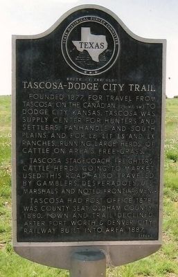
Route of the Old Tascosa-Dodge City Trail
Founded 1877, for travel from Tascosa, on the Canadian (25 mi. SW) to Dodge City, Kansas. Tascosa was supply center for hunters and settlers, Panhandle and South Plains; and for LE, LIT, LS and LX Ranches, running large herds of cattle on area's free grass.
Tascosa stagecoach, freighters, cattle herds going to market used this road -- also traveled by gamblers, desperadoes, U.S. Marshals and noted frontiersmen.
Tascosa had post office, 1878; was county seat, Oldham County, 1880. Town and trail declined after Fort Worth & Denver City Railway built into area, 1887.
Erected 1966 by State Historical Survey Committee. (Marker Number 4373.)
Topics. This historical marker is listed in these topic lists: Industry & Commerce • Railroads & Streetcars • Roads & Vehicles • Settlements & Settlers. A significant historical year for this entry is 1877.
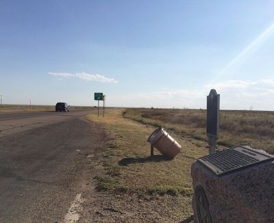
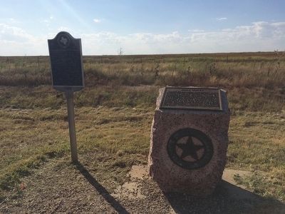
Location. 35° 45.656′ N, 101° 57.514′ W. Marker is in Dumas, Texas, in Moore County. Marker is on U.S. 87, 0.3 miles south of Road U, on the right when traveling south. Touch for map. Marker is in this post office area: Dumas TX 79029, United States of America. Touch for directions.
Other nearby markers. At least 8 other markers are within 13 miles of this marker, measured as the crow flies. Moore County (here, next to this marker); Site of Historic Drift Fence (approx. 5.6 miles away); Geological Riches of Moore County (approx. 5.7 miles away); Quanah Parker Trail (approx. 5.7 miles away); City of Dumas (approx. 6.8 miles away); Moore County Courthouse (approx. 6.8 miles away); Masterson (approx. 8.8 miles away); Route of Tascosa-Dodge City Trail (approx. 12.9 miles away). Touch for a list and map of all markers in Dumas.
Also see . . . Texas State Historical Association article on trail. (Submitted on September 20, 2015, by Mark Hilton of Montgomery, Alabama.)
Credits. This page was last revised on June 16, 2016. It was originally submitted on September 20, 2015, by Mark Hilton of Montgomery, Alabama. This page has been viewed 1,963 times since then and 119 times this year. Photos: 1, 2, 3. submitted on September 20, 2015, by Mark Hilton of Montgomery, Alabama.


