Near Amarillo in Potter County, Texas — The American South (West South Central)
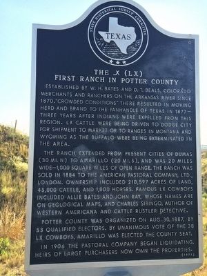
The _X (LX) First Ranch in Potter County
Established by W. H. Bates and D. T. Beals, Colorado merchants and ranchers on the Arkansas River since 1870. "Crowded conditions" there resulted in moving herd and brand to the Panhandle of Texas in 1877 — three years after Indians were expelled from this region. LX cattle were being driven to Dodge City for shipment to market or to ranges in Montana and Wyoming as the buffalo were being exterminated in the area.
The ranch extended from present cities of Dumas (30 mi. N) to Amarillo (20 mi. S), and was 20 miles wide—1,000 square miles of open range. The ranch was sold in 1884 to the American Pastoral Company, Ltd., London. Ownership included 210,597 acres of land, 45,000 cattle and 1,000 horses. Famous LX cowboys included Allie Bates and John Ray, whose names are on geological maps, and Charles Siringo, author of Western Americana and Cattle Rustler Detective.
Potter County was organized on Aug. 30, 1887 by 53 qualified electors. By unanimous vote of the 38 LX cowboys, Amarillo was elected the county seat. In 1906 the Pastoral Company began liquidating. Heirs of large purchasers now own the properties.
Erected 1971 by State Historical Survey Committee. (Marker Number 5458.)
Topics. This historical marker is listed in these topic lists: Agriculture • Industry & Commerce. A significant historical year for this entry is 1870.
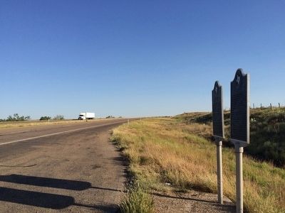
Location. 35° 27.324′ N, 101° 52.194′ W. Marker is near Amarillo, Texas, in Potter County. Marker is on U.S. 87, one mile south of Canadian River Road, on the right when traveling south. Located 1.2 miles south of the Canadian River. Touch for map. Marker is in this post office area: Amarillo TX 79108, United States of America. Touch for directions.
Other nearby markers. At least 8 other markers are within 14 miles of this marker, measured as the crow flies. The United States Topographical Engineers in the High Plains of Texas (here, next to this marker); The Canadian River (approx. 1.6 miles away); Great Spanish Road / First Ranch in Potter County / First Store in Potter County (approx. 1.6 miles away); First Cemetery in Potter County (approx. 1.7 miles away); First Gas Well in the Panhandle of Texas (approx. 9.3 miles away); McBride Ranch House (approx. 9.9 miles away); a different marker also named The Canadian River (approx. 12.3 miles away); Masterson (approx. 13.3 miles away). Touch for a list and map of all markers in Amarillo.
Also see . . . Texas State Historical Association article on ranch. (Submitted on September 20, 2015, by Mark Hilton of Montgomery, Alabama.)
Credits. This page was last revised on June 16, 2016. It was originally submitted on September 20, 2015, by Mark Hilton of Montgomery, Alabama. This page has been viewed 916 times since then and 118 times this year. Photos: 1, 2, 3. submitted on September 20, 2015, by Mark Hilton of Montgomery, Alabama.


