
Petersburg, Virginia — The American South (Mid-Atlantic)
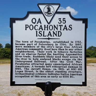
Pocahontas Island
Photographed by Bernard Fisher, September 20, 2015
1. Pocahontas Island Marker
Erected 2015 by Department of Historic Resources. (Marker Number QA-35.)
Topics and series. This historical marker is listed in these topic lists: African Americans • Indigenous Peoples and Communities • Settlements & Settlers. In addition, it is included in the Virginia Department of Historic Resources (DHR) series list. A significant historical year for this entry is 1752.
Location. 37° 14.194′ N, 77° 24.097′ W. Marker
this page online

Regionally, this marker is in Central Virginia. It is also in the American South and specifically in the Upper South. Globally, it is in North America, the Western Hemisphere, the Western World, and the Anglosphere. Historically, it finds itself in what was once the territory of the Mississippian Culture, one of the original Thirteen Colonies, one of the Confederate States of America, and the Antebellum South.
Other nearby markers. At least 8 other markers are within walking distance of this marker: Charles Stewart (here, next to this marker); South Side Station (approx. 0.2 miles away); a different marker also named South Side Station (approx. ¼ mile away); Bollingbrook Hotel (approx. ¼ mile away); The McIlwaine House (approx. ¼ mile away); Ladies Confederate Hospital (approx. ¼ mile away); Farmers Market (approx. ¼ mile away); 1864-1865: The Bombardment of Petersburg
Photographed by Bernard Fisher, September 20, 2015
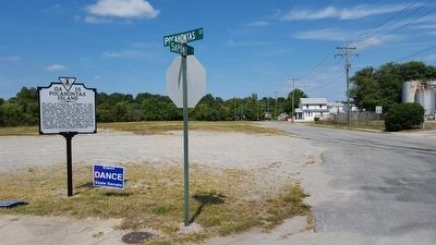
2. Pocahontas St & Sapony St
Other markers no longer nearby. Pocahontas (was within shouting distance of this marker but has been confirmed missing); The Battle at the Bridge (was about 500 feet away, measured in a direct line but has been confirmed missing); a different marker also named South Side Station (was approx. ¼ mile away but has been replaced with another marker now near it).
Also see . . . Pocahontas Island Historic District. National Register of Historic Places (Submitted on November 11, 2021.)
Credits. This page was last revised on February 2, 2023. It was originally submitted on September 21, 2015, by Bernard Fisher of Richmond, Virginia. This page has been viewed 922 times since then and 59 times this year. Photos: 1, 2. submitted on September 21, 2015, by Bernard Fisher of Richmond, Virginia.
