Booneville in Prentiss County, Mississippi — The American South (East South Central)
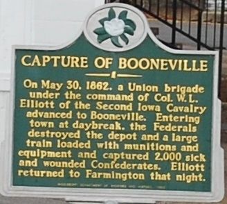
Capture Of Booneville
On May 30, 1862, a Union brigade under the command of Col. W.L. Elliott of the Second Iowa Cavalry advanced to Booneville. Entering town at daybreak, the Federals destroyed the depot and a large train loaded with munitions and equipment and captured 2,000 sick and wounded Confederates. Elliott returned to Farmington that night.
Erected 1999 by Mississippi Department of Archives and History.
Topics and series. This historical marker is listed in these topic lists: Railroads & Streetcars • War, US Civil. In addition, it is included in the Mississippi State Historical Marker Program series list. A significant historical date for this entry is May 30, 1862.
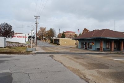
Location. 34° 39.303′ N, 88° 33.734′ W. Marker is in Booneville, Mississippi, in Prentiss County. Marker is at the intersection of West Church Street and Truman Street, on the left when traveling west on West Church Street. Touch for map. Marker is in this post office area: Booneville MS 38829, United States of America. Touch for directions.
Other nearby markers. At least 8 other markers are within 8 miles of this marker, measured as the crow flies. Council of War (approx. ¼ mile away); Booneville Armory (approx. 0.9 miles away); Booneville (approx. one mile away); Battle of Booneville (approx. 1.2 miles away); Campground Cemetery (approx. 5 miles away); Blackland Church and Cemetery (approx. 6 miles away); Blackland Methodist Church (approx. 6 miles away); Samuel L. Neely (approx. 8 miles away). Touch for a list and map of all markers in Booneville.
Credits. This page was last revised on December 11, 2016. It was originally submitted on September 25, 2015, by Brandon Fletcher of Chattanooga, Tennessee. This page has been viewed 393 times since then and 29 times this year. Photos: 1, 2, 3. submitted on September 25, 2015, by Brandon Fletcher of Chattanooga, Tennessee. • Bernard Fisher was the editor who published this page.


