William Penn Annex East in Philadelphia in Philadelphia County, Pennsylvania — The American Northeast (Mid-Atlantic)
The President's House Site 1790-1800
Independence National Historical Park
| — | National Park Service, U.S. Department of the Interior | — |
Photographed by Beverly Pfingsten, July 5, 2008
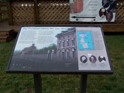
1. The President's House Site 1790-1800 Marker
President George Washington called the elegant three-story brick mansion that once stood on this spot "the best single house in the city." Both Presidents Washington (1790-1797) and John Adams (1797-1800) lived and worked in this house, which was rented from financier Robert Morris. Washington's large household included enslaved African descendants, contrasted with Adams' small household. Adams never owned slaves.
The President's house in the 1790s was a mirror of the young republic, reflecting both the ideals and contradictions of the new nation. The house stood in the shadow of Independence Hall, where the words "All men are created equal" and We the People were adopted, but they did not apply to all who lived in the new United States of America.
Independence National Historical Park is working with the community to interpret the President's House Site and to commemorate the enslaved African descendants who lived and toiled there. A permanent exhibit will be created on this open site near the entrance to the Liberty Bell Center.
[Sidebar:]
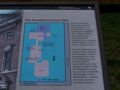
Records show that Washington and his family slept over the kitchen. His servants including the enslaved African descendants, slept in the former smokehouse and throughout the property. Adams left on record of how he used the house.
Hercules, Washington's enslaved cook, presided in the kitchen and was considered one of the best chefs in America. In 1797 Hercules successfully seized his freedom. With the help of Philadelphia's large free African community, Oney Judge, Martha Washington's enslaved servant, escaped to freedom from here.
Erected by National
this page online
Topics and series. This historical marker is listed in these topic lists: Abolition & Underground RR • African Americans • Patriots & Patriotism • Settlements & Settlers. In addition, it is included in the Former U.S. Presidents: #01 George Washington, and the Former U.S. Presidents: #02 John Adams series lists. A significant historical year for this entry is 1797.
Location. This marker has been replaced by another marker nearby. It was located near 39° 57.029′ N, 75° 9.01′ W. Marker was in Philadelphia, Pennsylvania, in Philadelphia County. It was in William Penn Annex East. It was at the intersection of Market Street and 6th Street, on the left when traveling west on Market Street. Touch for map. Marker was at or near this postal address: 101 Market St, Philadelphia PA 19106, United States of America. Touch for directions.

Regionally, this marker was in Southeast Pennsylvania. It was also in the American Northeast and in the Mid-Atlantic. Globally, it was in North America, the Western Hemisphere, the Western World, and the Anglosphere. Historically, it found itself
Photographed by Beverly Pfingsten, July 5, 2008
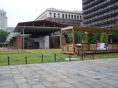
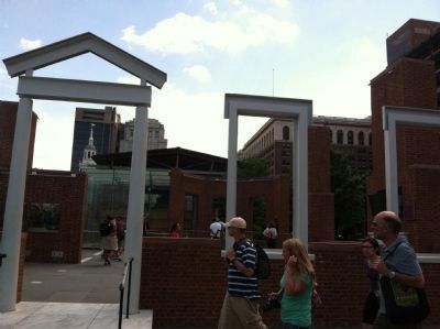
2. Outline of President's House
Area is just in front of the entrance to the Liberty Bell building.
Other nearby markers. At least 6 other markers are within walking distance of this location: Taking the Oath (here, next to this marker); The Ambassadors Clause (here, next to this marker); History Lost & Found (a few steps from this marker); State of the Union (a few steps from this marker); Treaties and Appointments (a few steps from this marker); The Executive Mansion (a few steps from this marker). Touch for a list and map of all markers in Philadelphia.
Other markers no longer nearby. Archeology Methods and Interpretation (was here, next to this marker but has been replaced with another marker now near it); The President's House - Washington and Adams (was here, next to this marker but has been replaced with another marker now near it); Enslaved Africans in the Household of George and Martha Washington (was here, next to this marker but has been replaced with another marker now near it); Chef Hercules (was here, next to this marker but has been replaced with another marker now near it); Contagion and Liberty
Photographed by Beverly Pfingsten, July 5, 2008
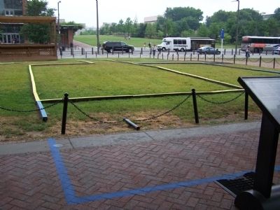
3. Outline of the President's House from the rear.
Also see . . . Brief History of the President's House. (Submitted on July 8, 2008, by Bill Pfingsten of Bel Air, Maryland.)
Photographed by Beverly Pfingsten, July 5, 2008
4. Close view of diagram on marker.
Photographed by Pat Filippone, June 19, 2013
5. The President's House Site 1790-1800 Marker
Credits. This page was last revised on July 26, 2026. It was originally submitted on July 6, 2008, by Bill Pfingsten of Bel Air, Maryland. This page has been viewed 4,071 times since then and 118 times this year. Photos: 1, 2, 3, 4. submitted on July 6, 2008, by Bill Pfingsten of Bel Air, Maryland. 5. submitted on May 25, 2015, by Pat Filippone of Stockton, California.
