Loveland in Larimer County, Colorado — The American Mountains (Southwest)
Lone Tree School
Photographed by Mark Hilton, September 14, 2015
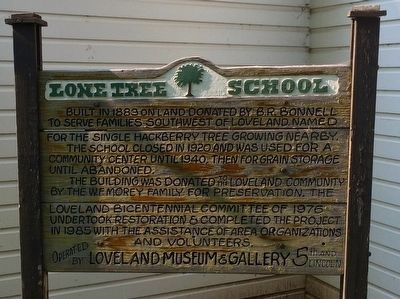
1. Lone Tree School Marker
Built in 1883 on land donated by B.R. Bonnell to serve families southwest of Loveland. Named for the single Hackberry tree growing nearby.
The school was closed in 1920 and was used as a community center until about 1940, then for grain storage until abandoned.
The building was donated to the Loveland community by the W.F. Morey family for preservation. The Loveland Bicentennial Committee of 1976 undertook restoration & completed the project in 1985 with the assistance of area organizations and volunteers.
Operated by the Loveland Museum & Gallery 5th and Lincoln
Erected 1976 by the Loveland Museum & Gallery.
Topics. This historical marker is listed in these topic lists: Agriculture • Education • Notable Buildings. A significant historical year for this entry is 1883.
Location. 40° 25.138′ N, 105° 5.708′ W. Marker is in Loveland, Colorado, in Larimer County. It is on West Lake Park Road 0.1 miles east of North Taft Avenue (County Road 17), on the right when traveling east. Touch for map. Marker is at or near this postal address: West Lake Park Road, Loveland CO 80538, United States of America.
this page online

Regionally, this marker is in the Front Range. It is also in the American Mountain West. Globally, it is in North America, the Rocky Mountains, the Western Hemisphere, the Western World, and the Anglosphere. Historically, it finds itself in what was once the Louisiana Purchase.
Other nearby markers. At least 8 other markers are within 2 miles of this marker, measured as the crow flies: The Actor (approx. ¼ mile away); The Planting of a Sculpture Garden (approx. ¼ mile away); Sculpture in the Park Artists (approx. 0.3 miles away); Loveland High Plains Art Council Founding Board Members (approx. 0.3 miles away); Sculpture in the Park Volunteers (approx. 0.3 miles away); Sculpture in the Park 25th Anniversary (approx. 0.3 miles away); "Power Of Thought" (approx. 0.4 miles away); Replica of the Statue of Liberty (approx. 1.1 miles away). Touch for a list and map of all markers in Loveland.
Photographed by Mark Hilton, September 14, 2015
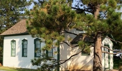
2. Lone Tree School
Photographed by Mark Hilton, September 14, 2015
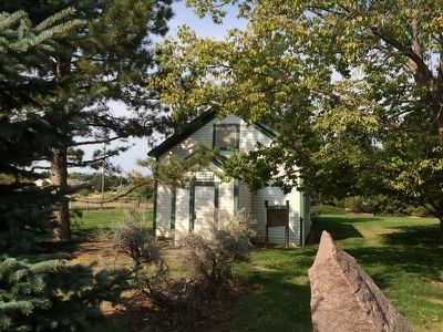
3. Lone Tree School
Photographed by Mark Hilton, September 14, 2015
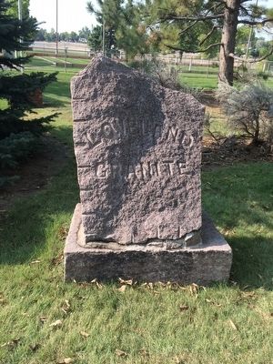
4. Granite stone outside school.
Credits. This page was last revised on June 16, 2016. It was originally submitted on October 2, 2015, by Mark Hilton of Montgomery, Alabama. This page has been viewed 2,046 times since then and 171 times this year. Photos: 1, 2, 3, 4. submitted on October 2, 2015, by Mark Hilton of Montgomery, Alabama.
