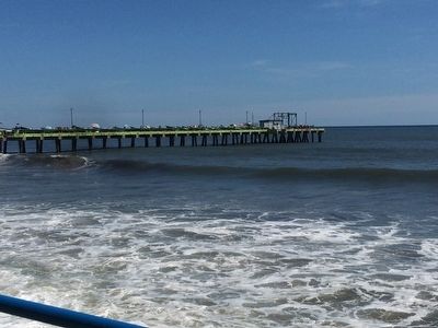
La Libertad, El Salvador — Central America (West Coast)
Puerto de La Libertad
La Libertad Port of El Salvador
Inscription.
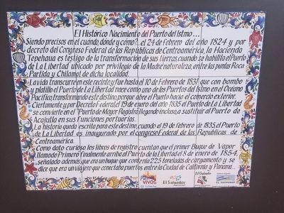
El Histórico Nacimiento del Puerto del Istmo...
Siendo precisos en el cuándo, dónde y cómo?...el 24 de febrero del año 1824 y por decreto del Congreso Federal de las Repúblicas de Centroamérica, la Hacienda Tepehaua es testigo de la transformación de sus tierras cuando habilita el “Puerto La Libertad” ubicado por privilegio de la Madre naturaleza, entre las puntas Roca Partida y Chilamat de dicha localidad.
La vida transcurre en este recinto, y fue hasta el 10 de Febrero de 1831 que con bombo y platillo el Puerto de La Libertad nace como uno de los Puertos del Istmo en el Océano Pacífico, transformando este destino, porque abre el Puerto hacia el comercio exterior. Ciertamente y por Decreto Federal, el 19 de enero del año 1835 el Puerto de La Liberta se convierte en El “Puerto de Mayor Registro.” llegando incluso, a sustituir al Puerto de de Acajutla en sus funciones portuarias.
La historia queda escrita para este destino, cuando 19 de febrero de 1835, el Puerto de Libertad es inaugurado por el congreso Federal de las Repúblicas de Centroamérica.
Como dato curioso… los libros de registro cuentan que el primer Buque de Vapor llamado “Primero” finalmente arriba al Puerto de la Libertad el 8 de enero de 1854, señalado además, que era un buque que contenía 225 toneladas de cargamento y se dice que era un viajero que conectaba puertos entre la Ciudad de California y Panamá.
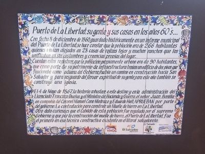
Puerto de la Libertad: su gente y sus casas en los años 60’s…;
Con fecha 8 de diciembre de 1860, guardado históricamente en un informe municipal del Puerto de La Libertad, se hace constar que la población era de 226 habitantes quienes vivían alojados en 28 casas de rojizas tejas y muchos ranchos que los unificaban en sus costumbres y creencias propias del lugar.
Cuentan estos registros, que la población propiamente urbana era de 90 habitantes, que como parte de su patrimonio de infraestructura tenían un edificio de dos pisos que funcionaba como aduana del Gobierno, había un camino en construcción hacia San Salvador y para reguardo del fervor espiritual de su gente, para este año también se construyó una iglesia.
El 4 de Mayo de 1867, la historia robustece a este destino y en la administración del Licenciado Francisco Dueñas y el Ministro de Haciendo y Guerra, el señor Juan Bonilla en compañía del Coronel Manuel Cano Medrazo y Eduardo Hall, APRUEBAN por parte del gobierno: La contratación para construir un Muelle de hierro en La Libertad. Otro dato curioso,
es que el Cabildo de esta población fue regalado por el supremo Gobierno y que por la construcción del muelle de hierro…el Puerto de La Libertad, fue el primero en esa técnica constructiva existente en el litoral salvadoreño.
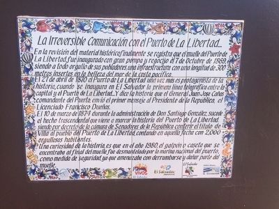
La Irreversible Comunicación con el Puerto de La Libertad…
En la revisión del material histórico, finalmente se registra que el muelle del Puerto de La Libertad, fue inaugurado con gran pompa y regocijo el 7 de Octubre de 1869, siendo a todo orgullo de sus pobladores, una infraestructura con una longitud de 300 metros insertos en la belleza del mar de la costa pacífica.
El 27 de abril de 1870 el Puerto de La Libertad una vez más es el protagonista de la historia, cuando se inaugura en El Salvador la primera línea telegráfica entra la capital y el Puerto de La Libertad…Y dice la historia que el General Juan Jose Cañas comandante del Puerto, envió el primer mensaje al Presidente de la República, el Licenciado Francisco Dueñas.
El 10 de marzo de 1874 durante la administración de Don Santiago González, sucede el hecho trascendental que viene a marcar la historia del Puerto de La Libertad, siendo por decreto de la cámara de Senadores de la República conferir el título de Villa al pueblo del Puerto de La Libertad, contando en aquella fecha con 2,000 orgullosos habitantes.
Una curiosidad de la historia, es que en el año 1980, el galpón
o caseta que se encontraba al final del muelle fue desmantelado por la marina nacional del puerto, como medida de seguridad, y que amenazaba con derrumbarse y dañar parte del muelle.
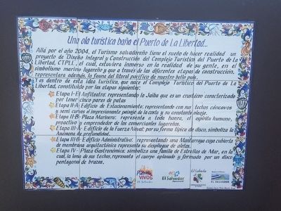
Una ola turística baña el Puerto de La Libertad…
Allá por el año 2004, el Turismo salvadoreño tiene el sueño de hacer realidad un proyecto de “Diseño Integral y Construcción del Complejo Turístico del Puerto de la Libertad, CTPLL”, el cual, estuviera inmerso en la realidad de su gente, en el simbolismo marino lugareño y que a través de las diferentes etapas de la construcción, representara además, la fauna del litoral pacífico de nuestro bello país.
Y es dentro de esta idea turística, que nace el Complejo Turístico del Puerto de la Libertad, constituido por la etapas siguientes:
∙ Etapa I – El Anfiteatro: representando la Jaiba que es un crustáceo caracterizado por tener cinco pares de patas
∙ Etapa II – A – Edificio de Estacionamiento: representando con sus techos cóncavos y semi curvos el impresionante paisaje de la costa y su constante oleaje.
∙ Etapa II – B – Plaza Marinera: representa a toda honra, el espíritu humano, proactivo y emprendedor de los comerciantes lugareños.
∙ Etapa III – A – Edificio de la Fuerza Naval: por su forma típica de disco, simboliza la Anémona de profundidad.
∙ Etapa III – B – Edificio Administrativo: representando una Mantarraya cuya cubierta de membrana arquitectónica representa su despliegue de aletas.
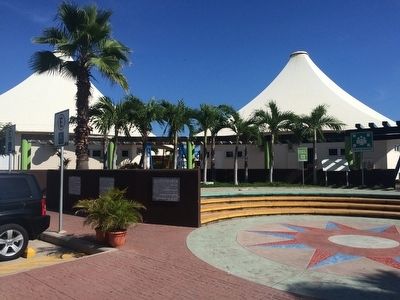
∙ Etapa IV – Plaza Gastronómica: simboliza una familia de Estrellas de Mar, en la cual, la lona de sus techos, representa el cuerpo aplanado y formado por un disco pentagonal de brazos.
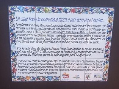
Un viaje hacia la oportunidad turística del Puerto de La Libertad…
La información recopilada muestra que en la Etapa I, la Cartera de Estado invirtió 2.36 millones de dólares, construyendo con una envidiable vista al mar, el anfiteatro que permite reunir a 3,500 personas cómodamente sentados; y el Malecón turístico de uso peatonal, en el cual las figuras marinas construidas en su recorrido, reciben y conducen a los lugareños y turistas hacia la vecina Playa Punta Roca, que por cierto, es considerada una de la favoritas a nivel mundial por los amantes del surf.
Por la naturaleza del destino, la Fuerza Naval, tiene también su espacio reservado, y entre los años 2007-2008, se construye la Etapa III – A, y es a partir del Convenio de Cooperación Bilateral, que les ha sido asignado para su operación.
A inicios de 2009, se construye la Etapa IV conocida Plaza Gastronómica, la cual ofrece a los visitantes y turistas en general, la oferta de 16 establecimientos turísticos comerciales, equipados,
amueblados, con espacio para 750 personas y una oferta turística complementaria de servicios, sanitarios, estacionamiento para 51 vehículos, con su respectiva caseta de vigilancia.
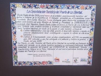
La Consolidación Turística del Puerto de La Libertad…
Desde finales del año 2009 y en el marco de un verdadero posicionamiento turístico del destino, el Gobierno de la República de El Salvador presidido por el Excelentísimo señor Presidente Don Carlos Mauricio Funes Cartagena quien, haciéndose acompañar de la sólida visión turística de señor Ministro de Turismo y Presidente de CORSATUR el Licenciado José Napoleón Duarte Durán, toman de la mano el Puerto de La Libertad para formarlo como producto turístico y lo elevan, consolidan y reconocen como una Ancla Turística Nacional, por medio de la puesta en valor turístico a través de:
∙ Edificio Administrativo: por medio de la puesta en valor turístico e impulso al comercio complementario local contribuyendo a mejorar la calidad de vida de sus habitantes.
∙ Edificio Estacionamiento: como un área complementario al CTPLL con capacidad para 253 vehículos y que fue entregada a la población y turistas en general, a finales del año 2010.
La Puesta en valor Turístico del Puerto de La Libertad ha permitido que finalmente la ciudad esté incluida en la oferta turística nacional y se continuará trabajando hasta consolidar la
ejecución del proyecto que CORSATUR ha denominado: “Diseño Arquitectónico Integral de la Plaza Marinera”, el cual será patrimonio turístico de la Ciudad del Puerto de La Libertad.
Ciudades, puertos, comunidades turísticos…
Son historias que nunca tienen fin…
The Historical Founding of the Port of the Isthmus ...
When, where and how? ... on 24 February 1824 and by a decree of the Federal Congress of the Central American Republics, the Tepehaua Plantation witnessed the transformation of its land into the "Puerto La Libertad", where it was privileged to have been created by Mother Nature, between Punta Roca Partida (Split Rock Point) and Chilamat.
Time moved on, until February 10, 1831, when with great fanfare, the Puerto de La Libertad was named as one of the ports of the isthmus on the Pacific Ocean, transforming this location, because it opened the region to foreign trade. With an additional Federal Decree on 19 January 1835, the Port of La Libertad became the main registered port in El Salvador, replacing the port of Acajutla.
Finally, on February 19, 1835, La Libertad Port is opened by the Federal Congress of the Republics of Central America.
Curiously ... the record books say that the first steamship, named "Primero", finally arrived at Puerto La Libertad on January 8, 1854.
This ship contained 225 tons of cargo and is said to have connected ports from California to Panama.
Puerto de la Libertad: Its people and their homes in the 1860's ...
On December 8, 1860 Puerto de La Libertad had a population of 226 inhabitants who lived in 28 red-tiled houses and many ranches and were unified in customs and beliefs common to the place at that time.
The urban population was 90 inhabitants. There was a two-story building that served as the Customs building, and a road was under construction to San Salvador. This same year a church was also built.
On May 4, 1867, the administration of Francisco Dueñas and the Minister of Government and War, Juan Bonilla, in the company of Colonel Manuel Medrazo Cano and Eduardo Hall, approved that a dock and pier was to be built at La Libertad made of iron. This was the first time that this type of construction would be made on the Salvadoran coast.
Irreversible Communication with the Port of La Libertad ...
The pier of La Libertad Port was finally inaugurated with great pomp and rejoicing on October 7, 1869, with all the pride of its inhabitants. It was 300 meters in length.
On April 27, 1870 Puerto de La Libertad once more made history when it opened in El Salvador the first telegraph line between the capital and the port... Gistory says that General Juan José Canas, the Port Commander, sent the first message to the President of the Republic, Francisco Dueñas by telegraph.
On March 10, 1874, during the administration of Santiago González, it was decreed by the Senate of the Republic that La Libertad Port was given the title of Villa (Town), having at that time 2,000 proud inhabitants.
A curiosity of history is that in 1980, the large shed that was at the end of the pier was dismantled by the Navy as a security measure, as it was threatening to collapse and damage the dock.
A Tourist Wave Bathes the Port of La Libertad ...
In 2004, Salvadoran tourism interests had a dream to realize a project called "Integrated Design and Construction of the Puerto de la Libertad, (CTPLL)" which was immersed in the reality of the people and in local marine symbolism. Through the different stages of construction, the fauna of the Pacific coast of our beautiful country was represented.
Within this idea the improvements to Puerto de la Libertad were made, comprising the following steps:
∙ Stage I - The Amphitheatre: representing the crab characterized by its five pairs of legs
∙ Stage II - A – Parking garage: representing with their semi-concave curved ceilings the stunning scenery the coast and its constant waves.
∙ Stage II - B - Plaza Marinera: representing the human, proactive and entrepreneurial
spirit of local merchants.
∙ Stage III - A - Building of the Navy: its typical disk-shape symbolizes a deep sea anemone.
∙ Stage III - B - Administration Building: A stingray is represented with its roof which is covered with an architectural deployment of fins.
∙ Stage IV – Restaurant Plaza: symbolizes a family of starfish, which, with its canvas roofs, represent its arms.
A Trip to the Tourist Opportunity of Puerto de La Libertad ...
In Stage I, the Government invested $2.36 million, built with an enviable view of the sea, in the amphitheater which can comfortably seat 3,500 people; the pedestrian Malecón, in which marine symbolism is prominently displayed and receives and leads locals and tourists to the nearby Playa Punta Roca, which incidentally, is considered a favorite worldwide for surfers.
The Navy also has a reserved space, and between the years 2007-2008, Stage III – A was built as part of a bilateral cooperation agreement.
In early 2009, the Phase IV building known as the Restaurant Plaza, which offers visitors and tourists in general 16 commercial tourist restaurant establishments, with space for 750 people and parking for 51 vehicles and a guardhouse.
Consolidation of Tourism at the Port of La Libertad ...
Since the end of 2009, the Government of El Salvador chaired by President Carlos Mauricio Funes Cartagena who, together with the solid vision of Minister of Tourism and President of CORSATUR, José Napoleon Duarte Durán, have positioned Puerto de La Libertad as a real tourist destination.
∙ Administration Building: An additional value added to local tourism helping to improve the quality of life of its inhabitants.
∙ Parking Garage: A complementary area to accommodate 253 vehicles, delivered to the population and tourists in 2010.
The value of the Port of La Libertad has finally allowed the city to be included in national tourism projects and continues to strengthen the implementation of the project CORSATUR has called "Comprehensive Architectural Design", which will be a part of the touristic heritage of the city of Puerto de La Libertad.
Cities, ports, tourist communities ...
are stories that never end ...
Topics. This historical marker is listed in these topic lists: Industry & Commerce • Man-Made Features • Waterways & Vessels. A significant historical year for this entry is 1831.
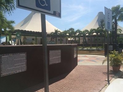
Location. 13° 29.226′ N, 89° 19.211′ W. Marker is in La Libertad. The six markers can be seen south of the small parking area near the Restuarant Plaza of La Libertad Port. Touch for map. Marker is in this post office area: La Libertad 01511, El Salvador. Touch for directions.
Other nearby markers. At least 8 other markers are within 23 kilometers of this marker, measured as the crow flies. Monument to the Victims of Las Colinas Landslide (approx. 20.2 kilometers away); In Memory of Those Americans Who Lost Their Lives in El Salvador (approx. 21 kilometers away); Madre Clara Maria de Jesus Quiros (approx. 21 kilometers away); Kiosk of Daniel Hernández Plaza (approx. 21.1 kilometers away); Tribute to Santa Tecla (approx. 21.1 kilometers away); One Hundred Years Since the Founding of Santa Tecla (approx. 21.1 kilometers away); Dr. Manuel Gallardo (approx. 21.1 kilometers away); Adalberto Guirola Children’s Home (approx. 21.2 kilometers away).
Credits. This page was last revised on April 2, 2023. It was originally submitted on October 13, 2015, by J. Makali Bruton of Accra, Ghana. This page has been viewed 1,367 times since then and 183 times this year. Photos: 1, 2, 3, 4, 5, 6, 7, 8, 9. submitted on October 17, 2015, by J. Makali Bruton of Accra, Ghana.
