
Rawlins in Carbon County, Wyoming — The American West (Mountains)
William Daley Flagpole
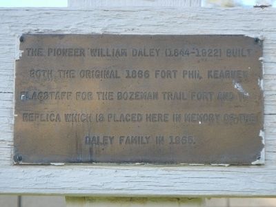
Photographed by Barry Swackhamer, September 9, 2015
1. William Daley Flagpole Marker
Topics. This historical marker is listed in this topic list: Man-Made Features.
Location. 41° 47.384′ N, 107° 14.444′ W. Marker is in Rawlins, Wyoming, in Carbon County. It can be reached from the intersection of West Pine Street and 5th Street, on the right when traveling west. Touch for map. Marker is at or near this postal address: 415 West Pine Street, Rawlins WY 82301, United States of America. Touch for directions.

Regionally, this marker is in Wyoming’s Westward Expansion Trails Region. It is also in the American Mountain West. Globally, it is in North America, the Rocky Mountains, the Western Hemisphere, the Western World, and the Anglosphere. Historically, it finds itself in what was once the Republic of Texas.
Other nearby markers. At least 7 other markers are within 7 miles of this marker, measured as the crow flies: Rawlins (about 500 feet away,
this page online
More about this marker. The flagpole is at the southwest corner of the Carbon County Courthouse grounds.
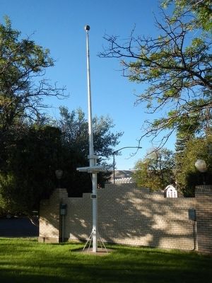
Photographed by Barry Swackhamer, September 9, 2015
2. William Daley Flagpole Marker
Credits. This page was last revised on June 16, 2016. It was originally submitted on October 18, 2015, by Barry Swackhamer of Brentwood, California. This page has been viewed 577 times since then and 30 times this year. Photos: 1, 2. submitted on October 18, 2015, by Barry Swackhamer of Brentwood, California.
